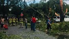
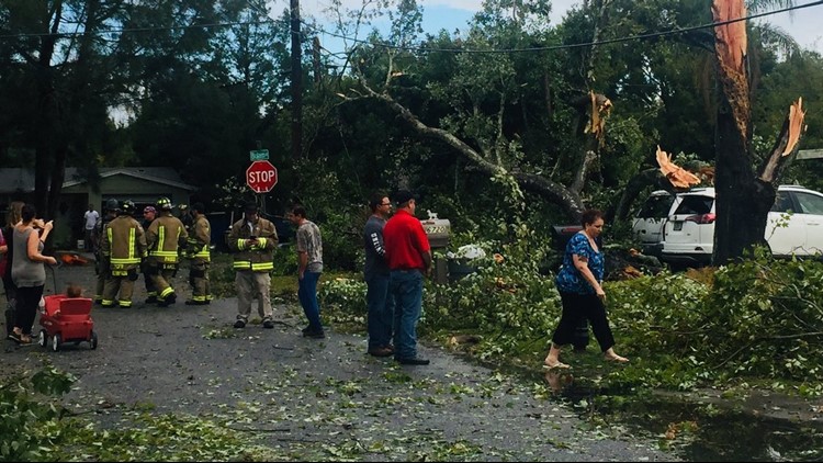
ST. PETERSBURG, Fla. -- Tampa Bay's recent bout of severe weather, including one EF-1 tornado in Pasco County, comes a little more than a month after the last event.
And another could happen Friday. They say two's a coincidence, could three times be a trend?
Look halfway around the world to help answer that question: It's becoming increasingly likely El Niño will form this upcoming 2018-19 winter season, according to the latest Climate Prediction Center outlook.
El Niño is associated with a band of warmer than average water largely along the equator in the Pacific Ocean. La Niña is its opposite, with colder than average water.
Both affect weather patterns worldwide, including in Florida. El Niño tends to bring the greatest impacts, with above average precipitation and increased storminess with a subtropical jet stream parked over the region. An El Niño scenario also typically features storm tracks that are farther south than those during a La Niña year.
"El Niño events shift global weather patterns," 10Weather's Bobby Deskins said. "Here in Florida, that shift means the southern jet stream moves over us. That stream not only brings storms to us, but the winds associated with it aloft help to make those storms stronger."
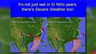

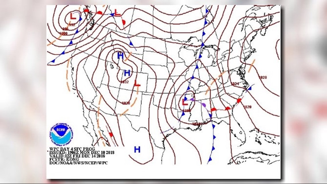
The weather system Sunday that spawned an EF-1 tornado in New Port Richey and another EF-1 tornado in Wimauma followed a path almost exactly to the example depicted right in the image above. A low-pressure system in the Panhandle was associated with a trailing cold front and a line of strong storms out ahead of it.
It wasn't particularly hot or humid during the weekend, but there was enough wind shear in the atmosphere that allowed even a marginal thunderstorm to rotate and pose the risk of producing tornadoes.
There's still more than enough time to hone in on Friday's forecast, but the latest surface map depicts another cold front pushing toward the Florida Gulf coast.
It remains several days away but bears watching: The exact detail in terms of timing, location of the front and its potential impacts will be hammered out this week. After that, this might be the season where this becomes the norm.
"El Niño years generally mean a cooler and wetter winter," Deskins said. "It also means we see a higher chance of severe weather, including tornadoes.
"The highest chance for severe weather usually occurs in February and March."
►Make it easy to keep up-to-date with more stories like this. Download the 10 News app now.
Have a news tip? Email tips@wtsp.com, visit our Facebook page or Twitter feed.