Good Tuesday morning I'm meteorologist Bobby Deskins and I'm already tracking rain across our area.
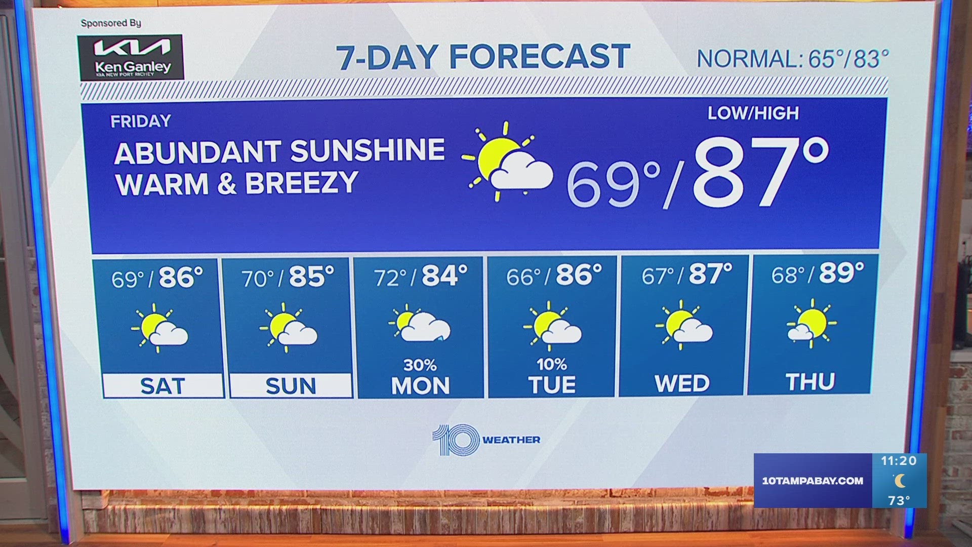
Tuesday has started with scattered showers through and that trend continues through lunchtime.In fact, more widespread rain is expected this afternoon. Rain coverage at 80%, with the highest coverage and highest rainfall amounts west of I-75. Mostly cloudy skies expected all day keeping high temperatures in the low 80s.
Scattered showers will continue overnight Tuesday into Wednesday morning. Rain coverage will be 60-70% including the morning commute.
Rain should be wrapped up by midday Wednesday, and then it is likely to be breezy with decreasing clouds. High temperatures will be a little cooler for a couple days in the low 80's range.
Don't forget that daylight saving time ends this weekend. That means that Saturday night before you go to bed, you need to move the clocks back 1 hour. That would put sunrise on Sunday at 6:41 AM and sunset Sunday afternoon is 5:46 PM.
Before heading out in the water, check the marine briefing here:
Track the storms: Stormtracker 10 Radar maps
Remember, when you are on the go, you can get StormTracker10 free on your phone by searching "WTSP Weather" (both words) in your App Store.
****** DO NOT EDIT BELOW THIS LINE ******
WX Briefing: In-depth Weather Report
Got weather photos to share? Email them to us at photos@wtsp.com
You may also like:
iPhone: Download![]() our Interactive Radar weather app in the iTunes
our Interactive Radar weather app in the iTunes![]() App Store. Click here or search WTSPWeather
App Store. Click here or search WTSPWeather
Android![]() Search WTSPWeather in the Google Play
Search WTSPWeather in the Google Play![]() Market
Market![]()
Text Alerts: For severe weather text alerts in your area, click here