
TAMPA, Fla. — The tropics are heating up as we continue to move through July.
On Monday, an area of low pressure, now classified as Invest 98L, moved onshore through the Florida Panhandle. The system is what's aiding in our increased rain chances on Monday and parts of Tuesday.
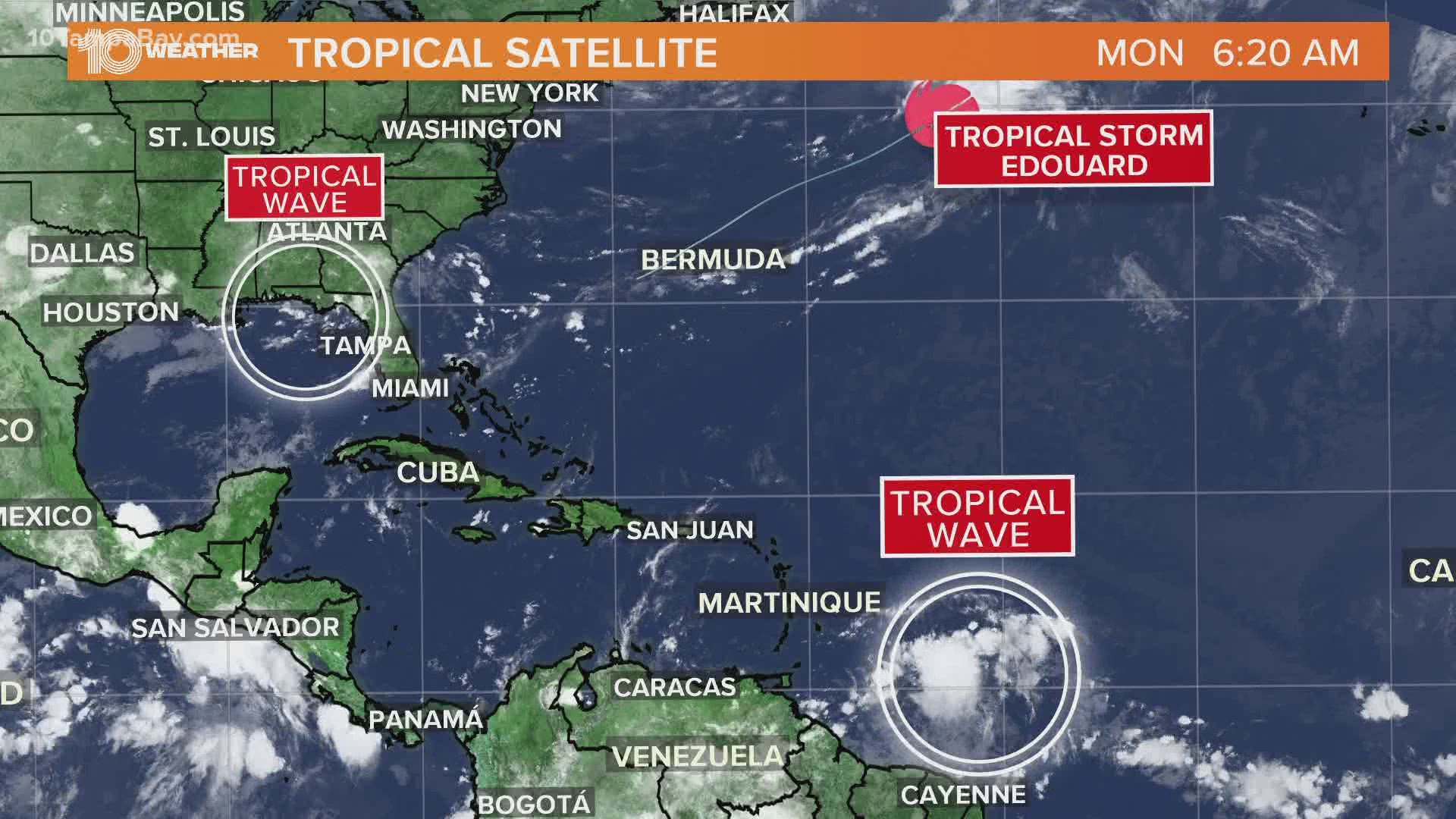
That system is not expected to develop into anything tropical Monday or Tuesday, but the potential for development increase if it moves back over the water near the Carolinas Wednesday or Thursday.
Right now, the National Hurricane Center gives it a 10 percent chance of development over the next two days and a 40 percent chance of development over the next five days.
Either way, it's going to be a rainmaker here in Florida and parts of the southeast.
On Sunday, Tropical Storm Edouard formed in the Atlantic, making it the earliest an "E" named storm has formed in the Atlantic basin on record. Edouard poses no threat to Florida.
It doesn't stop there.
There's a tropical wave moving toward the Eastern Caribbean Sea. The National Hurricane Center gives that system a 10 percent chance of developing over the next two and five days.
- Florida adds another 10,059 coronavirus cases in one day
- Pasco County gentlemen's club catches on fire
- Everything to know about the new St. Pete Pier opening, including how to get a reservation
- Police identify men struck by lightning on Clearwater Beach
- Bellagio error may be biggest sportsbook loss in Vegas history
- Clearwater Fire Medics deliver baby boy on Courtney Campbell beach
- Deadly amoeba that destroys brain infects person in Hillsborough County, health department warns
- Man in famous 9/11 photo dies of coronavirus in Florida


►Stay In the Know! Sign up now for the Brightside Blend Newsletter