ST. PETERSBURG, Fla. — Rapid intensification is a process many of the strongest hurricanes undergo in the course of development, and many environmental factors must be just right for it to occur.
People monitoring the forecast for Hurricane Ian have seen the phrase "rapid intensification" in many recent advisories from the National Hurricane Center. This should motivate people to prepare their hurricane plans and, if necessary, put them into action.
But what does it mean? Rapid intensification is an increase in the maximum sustained winds of a tropical cyclone of 35 mph in a 24-hour period, according to the hurricane center.
A storm that undergoes rapid intensification must have these factors in its favor: high water temperatures, abundant ocean heat content and low wind shear. You may have heard that warm surface ocean temperatures help to fuel tropical systems, and low wind shear means there's little to no wind that could contribute to disorganizing the storm.
Ocean heat content is a measure of the water temperature below the surface, NASA says. When a strong storm churns up the ocean, some of the cooler water is brought to the surface — and actually can cause a storm to be limited in getting stronger or weaken somewhat. But if ocean heat content is high, the water temperature deep below the surface remains at a high value and remains high even if brought to the surface.
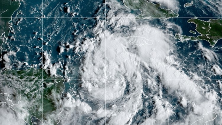
Here's what the National Hurricane Center wrote Sunday morning in its discussion about Tropical Storm Ian:
"Ian remains within an environment that appears quite conducive for strengthening. Once the circulation become[s] more vertically coherent, low vertical wind shear conditions and high ocean heat content are expected to allow for rapid intensification while Ian moves over the northwestern Caribbean Sea."
Ten of the 13 hurricanes during the 2020 Atlantic hurricane season rapidly intensified, tying the previous record set in 1995, according to NOAA. There's an "increased risk" to people and property when storms undergo this dangerous process and it is difficult to predict. Why? "If these storms’ wind speed increases significantly just before landfall, that leaves little time for appropriate preparations," scientists say.
10 Tampa Bay has helpful links including evacuation zones and storm surge maps, a page for county-by-county resources and even more on how to get prepared at 10TampaBay.com/tropics.