
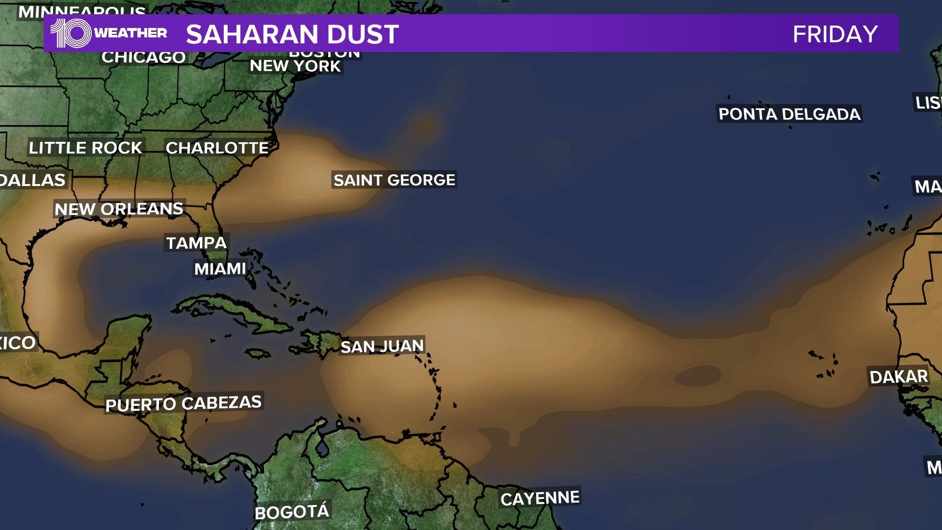
ST. PETERSBURG, Fla. — The much-discussed giant cloud of dust from the Sahara Desert in Africa has made it into the Gulf of Mexico, and it’s set to hang around well into next week.
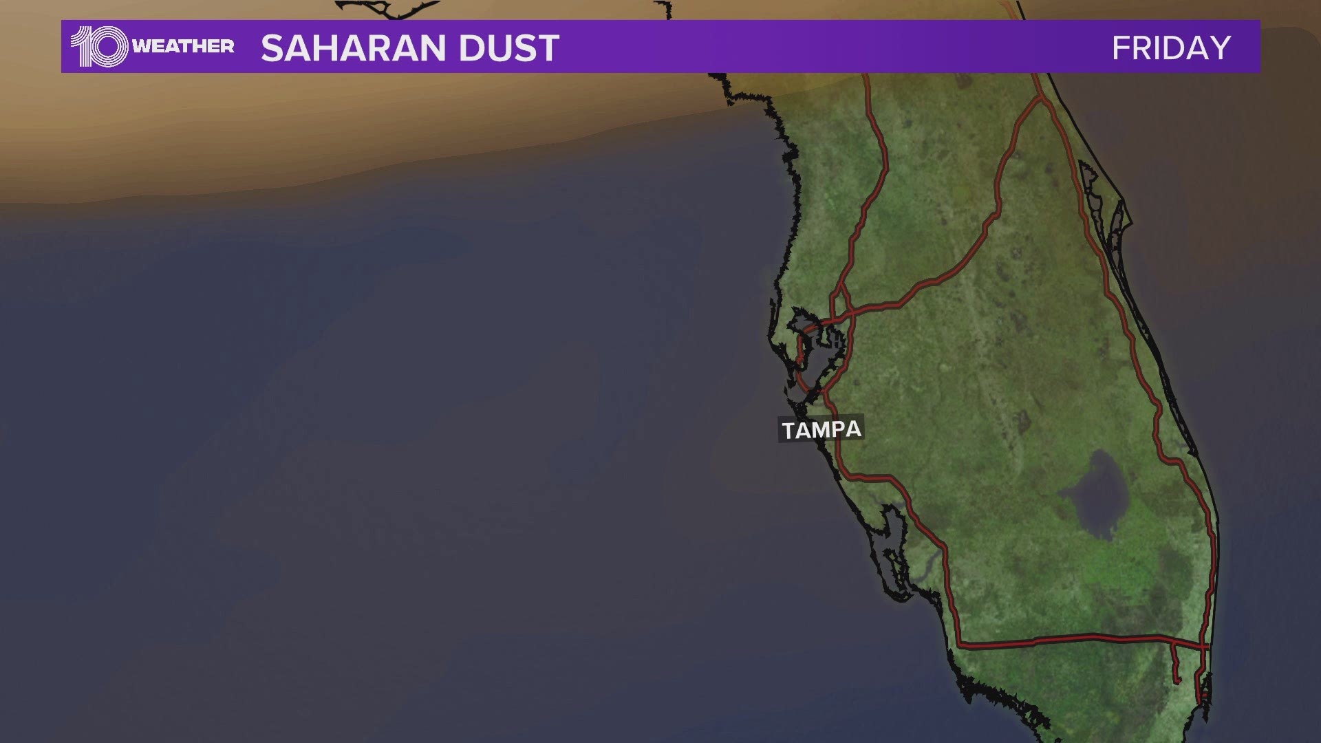
The 10 Tampa Bay weather model below shows upper-level winds curling the dust back around from the north across Tampa Bay next week. In the meantime, look west for the more distant dust and you may see more colorful sunsets starting tonight.
This dust plume has been historic, even called the ‘Godzilla’ cloud by many. In Puerto Rico, air quality fell to record “hazardous” levels.
The dust can also cause reactions for people with allergies and respiratory conditions. Those with respiratory issues face similar problems as they would experience when coming in contact with dust particles or smoke.
The massive dust plume produced extremely hazy conditions and limited visibility across much of the Caribbean, as seen in the video below.
Michael Lowry, former scientist with University Corporation for Atmospheric Research (UCAR), posted on Twitter this morning that “The ongoing Saharan dust outbreak across the tropical Atlantic is by far the most extreme of the MODIS satellite record — our most detailed, continuous record of global dust back to 2002.”
The cloud is abnormally large, and started coming off the African coast about a week ago and is still coming.
There are definite benefits to Saharan dust. It helps to temporarily suppress or lower tropical activity. It’s called the Saharan Air Layer (SAL). The SAL is hot, dry desert air that “caps” the lower atmosphere, putting a lid on thunderstorm development across the tropical Atlantic.
The hot air prevents pockets of air below from rising, while the dry air works to shred any clouds that do manage to tower, making it very difficult for tropical waves, disturbances and cyclones develop.
However, it’s a short term help. Once the dust disperses, the atmosphere will return to normal.
The 2020 hurricane season is still expected to see a higher than average number of storms. Another good feature of Saharan dust is that the dust can create more vibrant sunrises and sunsets. We may see more red and orange colored skies during our sunsets as solar light bounces off the scattered atmospheric dust particles. Photographers may want to have their cameras ready starting tonight.
- Bubba Wallace responds after FBI says noose found in stall there as early as Oct. 2019
- Coronavirus in Florida: State breaks another record with more than 5,000 new cases in a day
- NY, NJ and Connecticut to require travelers from COVID-19 hotspots, including Florida, to quarantine for 14 days
- Heat Advisory in effect for parts of the Tampa Bay area
- Police rescue dog left in hot car in Clearwater Beach parking garage
- 'It’s not over:' MacDill reservist who spent months on COVID-19 front lines in NYC returns home with warning
- Dr. Fauci hopeful for COVID-19 vaccine by late 2020, early 2021
- New cases, hospitalizations, deaths: How Florida is doing in its COVID-19 battle


►Stay In the Know! Sign up now for the Brightside Blend Newsletter