TAMPA, Fla. — A tornado watch is in effect until 5 p.m. for the entire Tampa Bay area. Click or tap here for the latest information on the storm threat.
The previous story is below.
---
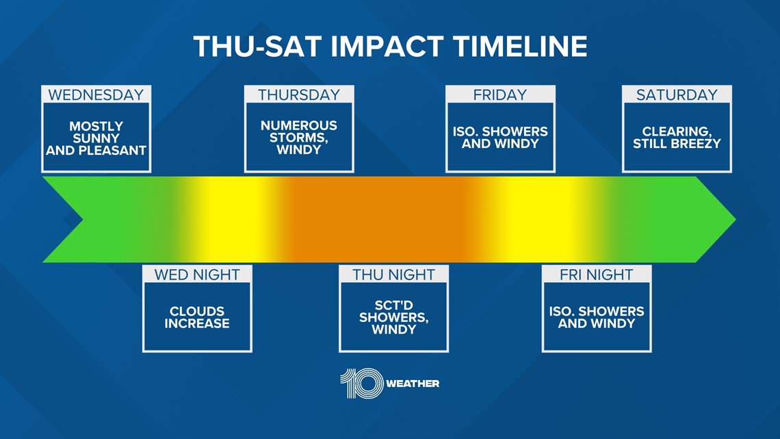
Before a much-anticipated Halloween weekend cooldown, we'll have to get through some windy and messy weather first. Here's the breakdown:
A strong cold front is quickly moving east across the South, pushing warm moisture ahead of it and cool drier air behind it across the Gulf of Mexico and onto the west Florida coast into Thursday.

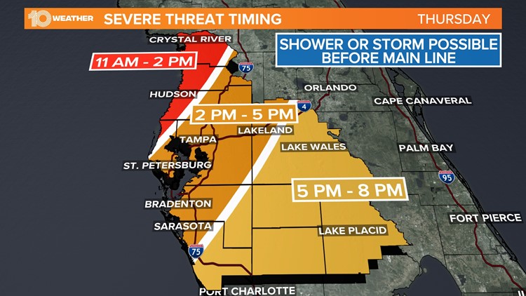
A "one-two punch" type of day is shaping up. Thursday's timing could change slightly, but the initial round of storms firing up along the preceding warm front looks to arrive between 6-9 a.m.

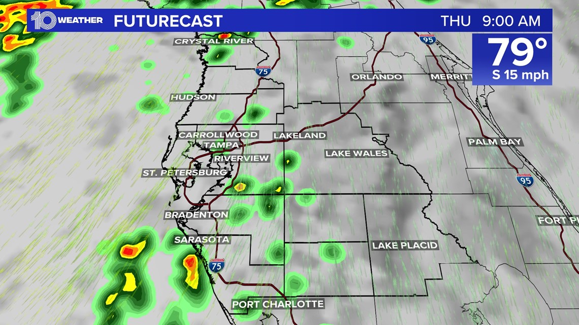
We'll get a small break in the rain before a second and gustier line of storms moves onshore well after lunchtime, through the mid-afternoon, between 3-5 p.m.

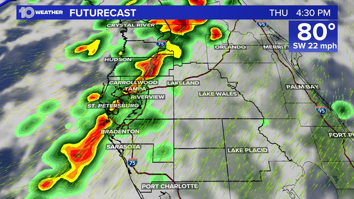
The Storm Prediction Center placed much of west-central Florida at a "slight risk" of severe weather Thursday — a level two out of five.
Enough instability, a warm and moist low-level flow and wind shear (a change of wind speed and/or direction with height) could lead to a few strong to severe storms, especially around and north of the Tampa Bay area, with damaging winds and an isolated waterspout or tornado among the main threats.

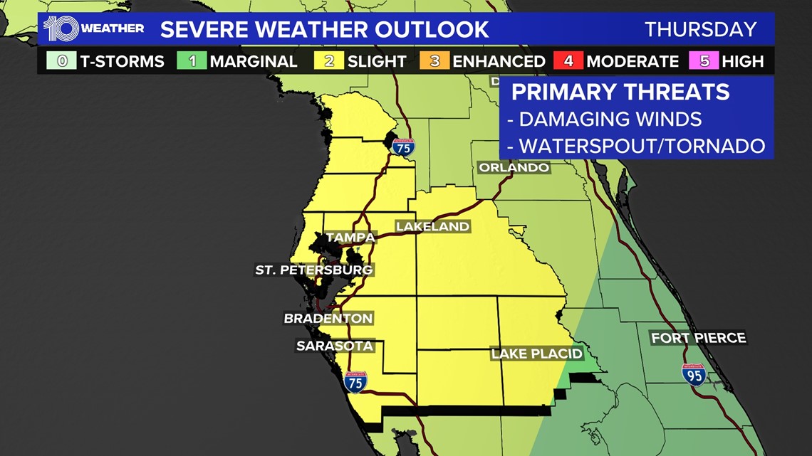
Localized flooding will also be possible, with some of the heftier storms capable of producing 1-3 inches of rainfall.
It would be wise to stay weather aware and have a way to get alerts through the day on Thursday.

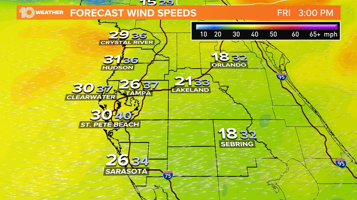
A couple of showers could linger into Friday, but the severe threat will be long gone at that time. However, 20-35 mph winds gusts, especially at the coast, are possible through the start of the weekend.
With that being said, now would be a good time to figure out what to do with those Halloween decorations.

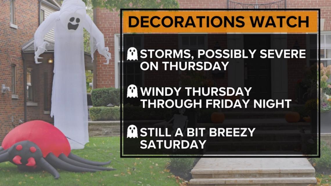
The storms alone could knock those ghouls and goblins into your neighbor's yard, but so, too, could the breezy cold front conditions Friday into Saturday morning.
Calmer and cooler air (hello mid-70s!) take over by the end of the weekend. If you brought any items indoors, you can get those decorations back out by Saturday afternoon and be in good shape for a fabulous-feeling Halloween Sunday.