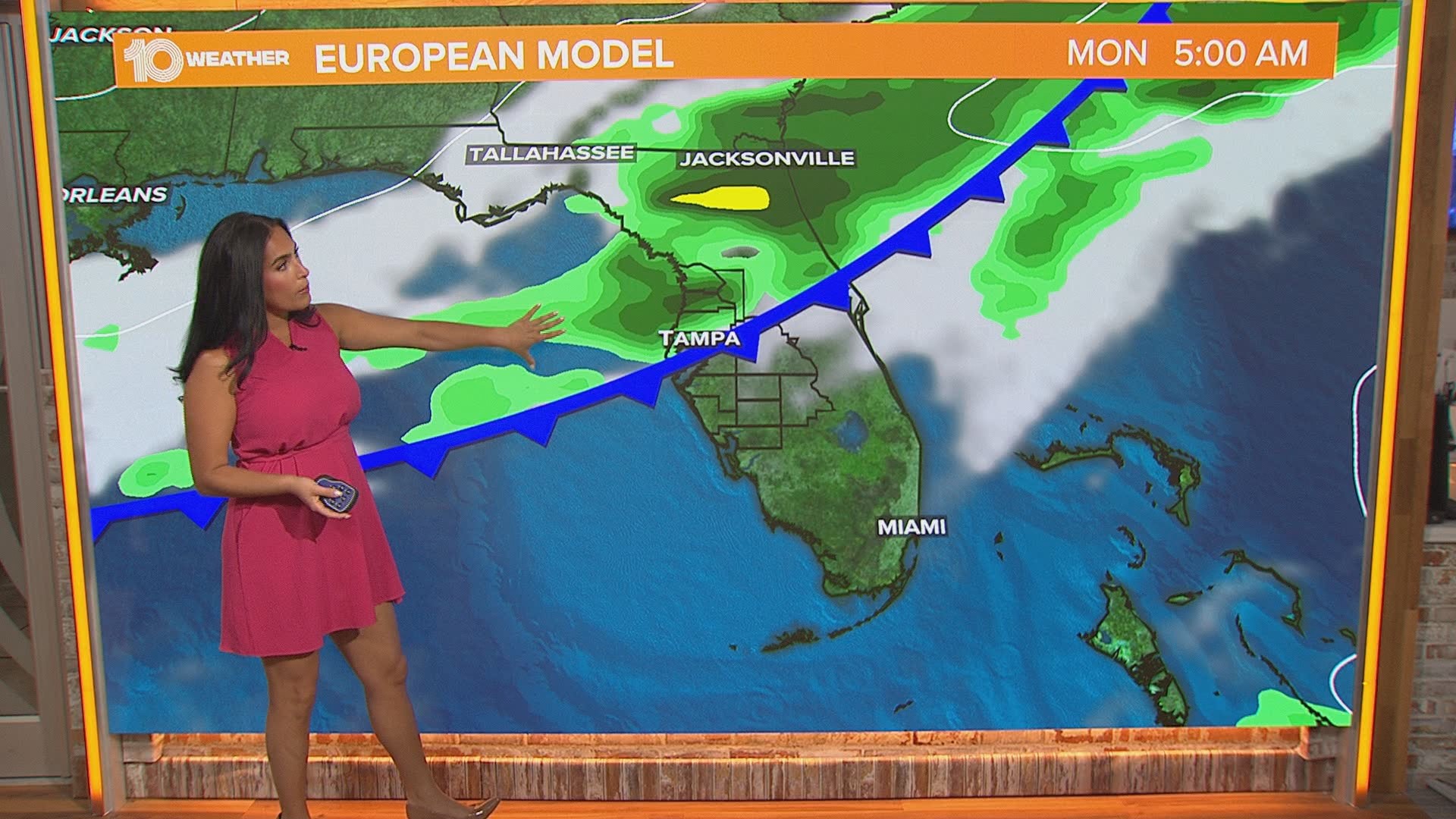
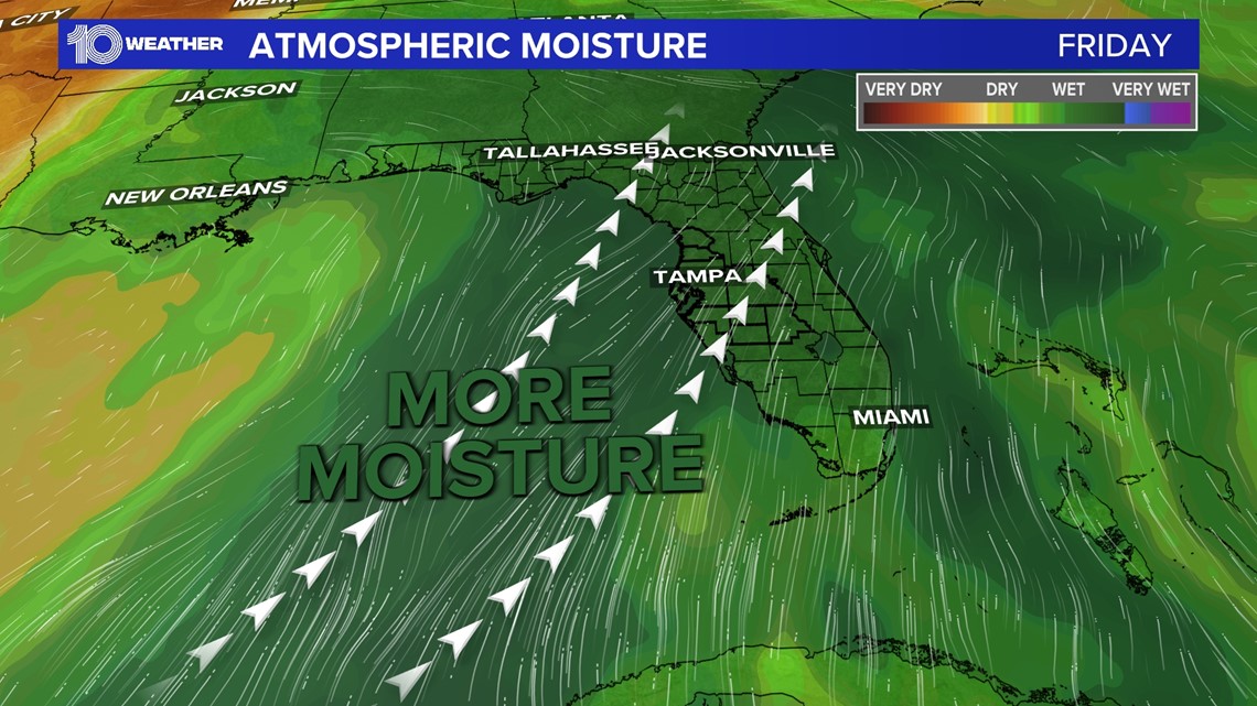
ST. PETERSBURG, Fla. — An upper-level trough over the northern Gulf of Mexico is pushing a stream of moisture in from the southwest. This system is not moving very fast, which will produce multiple rounds of showers and storms today into the weekend.
Along with locally heavy rainfall and areas of flooding will be the threat for waterspouts. Storms earlier during the day Thursday had already shown signs of rotation, in fact, there was a tornado warning in Pasco County.
That warning has since expired, and there have been no reports of damage.
With the flow of these storms moving from over the Gulf and onto coastal areas, there will be a threat for waterspouts. That threat will be highest during the morning hours

In the morning hours, a land breeze can develop and push out over the Gulf. That land breeze can interact with southwest winds over the Gulf to produce storms and rotation.
That rotation can get picked up by the updraft of the storms, producing a waterspout.

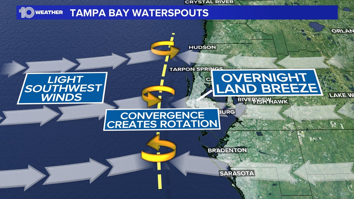
The lack of friction over water is the main reason why waterspouts can develop. Imagine spinning a top on a smooth table, it can spin for a long time. That's what a waterspout can do over water. Now try spinning that top over carpet and it might spin for a second or two before collapsing.
It's essentially the same thing for waterspouts because the friction from land, trees and buildings kills the rotation from the surface!
The Nature Coast will see the heaviest rainfall over the next several days and the highest chance for an isolated waterspout. Areas north of Tampa have the best upper-level support to produce stronger thunderstorms and areas of flooding with storms training over the same areas.
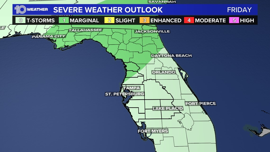
The Storm Prediction Center has the entire area under a marginal risk for severe weather on Thursday. The Nature Coast is under a marginal risk, a level one of five, for severe weather on Friday. Some storms could produce damaging downburst winds and an isolated weak tornado or waterspout.

A flood watch has been issued for Citrus County, for Friday to Saturday, but it might be expanded for more areas.