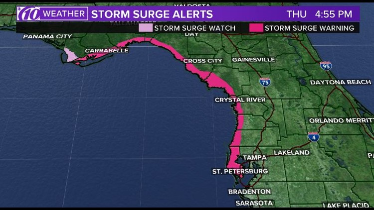
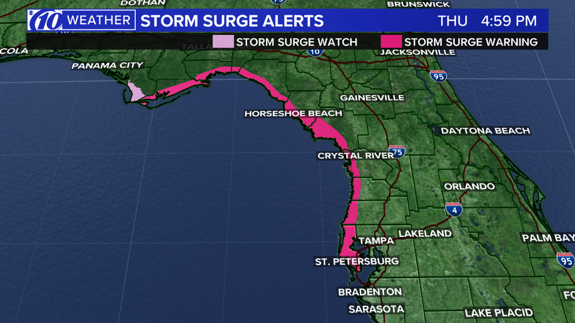
A storm surge warning is issued as far south as Pinellas County in preparation for developing Potential Tropical Cyclone Sixteen, currently moving out of the Bay of Campeche, near Mexico.
Right now, the storm is about 850 miles from Tampa. It has a 90 percent chance of developing into a named Tropical Storm and will be called Nestor. The storm is most likely to move into the panhandle of Florida over the weekend as a tropical storm. However, Tampa Bay is expected to have some impacts.
Minimal impacts will be a little more wind with increased rain chances. Some higher tides and potential storm surge will be possible as well.
A Tropical Storm Watch has also been issued for the coastal waters of Pasco, Hernando and Citrus counties.
Let's break down my potential concerns at this point.
TIMING: Midday Saturday through early Monday.
WINDS: Sustained winds 20-30 mph (gusts to 50). 2-4' surge possible.
RAIN TOTALS: 1-3" of rain possible.
TORNADO THREAT: There will be a somewhat favorable tornado threat in Tampa Bay as this storm moves through the Gulf of Mexico.
We'll bring you the latest information throughout the evening as we get updates from the National Hurricane Center. Hurricane hunters are flying in the storm this evening. It could become a named storm, Nestor, later tonight or early tomorrow.
FREE 10NEWS APP: