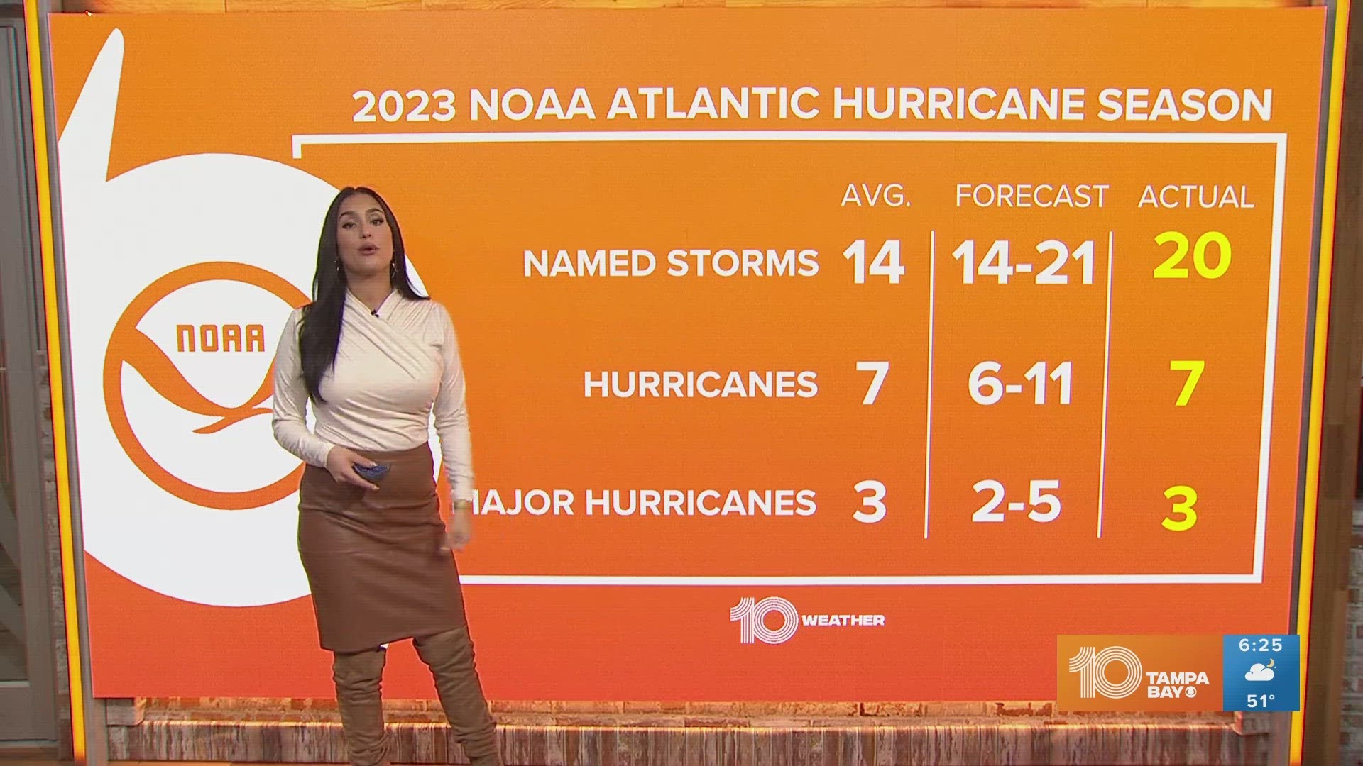
ST. PETERSBURG, Fla. — We’re wrapping up the second week in August with a rumble of tropical activity in the Gulf of Mexico.
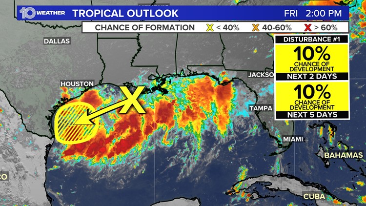
The National Hurricane Center is now monitoring an area of disturbed weather in the north-central Gulf of Mexico, just off the coast of Louisiana. As of Friday, the NHC is only giving this tropical disturbance (Invest 98-L) a low, 10-percent chance of development over the next two to five days.

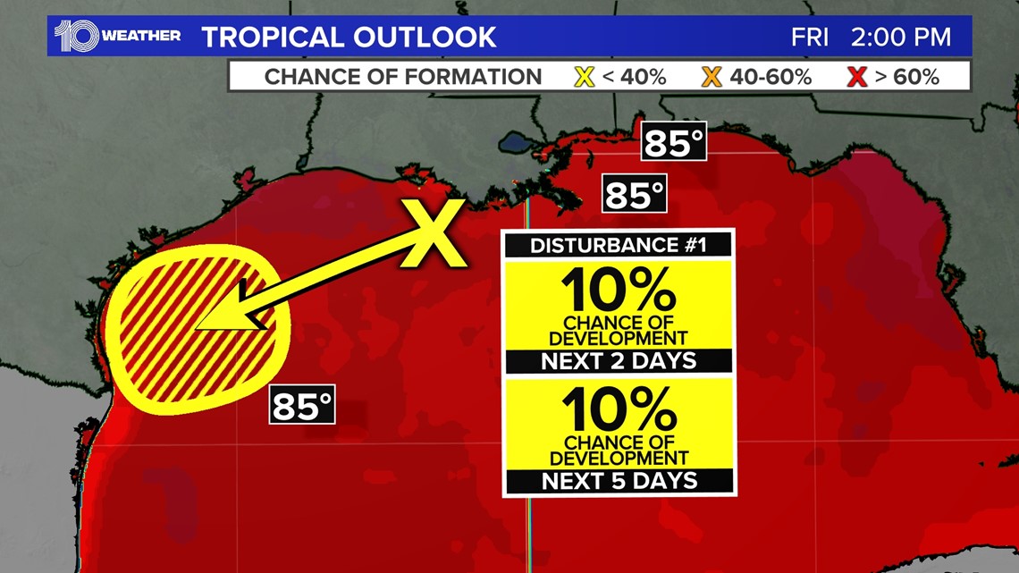
This area of low pressure (marked by the yellow "X") has been producing disorganized showers and thunderstorms across parts of the northern Gulf, coastal Louisiana and the eastern coast of Texas.
It will be difficult, yet not entirely impossible, for this disturbance to fully organize into something of tropical nature this weekend. However, it will be a rainmaker for portions of the Texas coast!

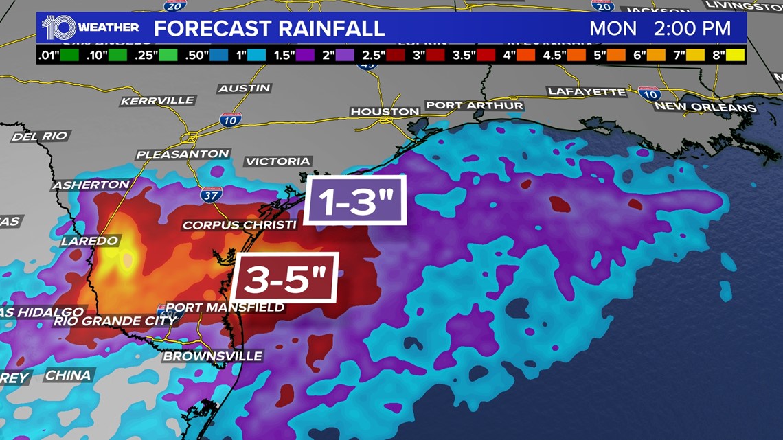
Locally heavy rainfall will be likely at times along portions of the Texas coast through the weekend, especially in south Texas. While the heaviest amounts are likely to remain just offshore over the Gulf, there is a marginal risk for excessive rainfall across parts of south Texas through Sunday.