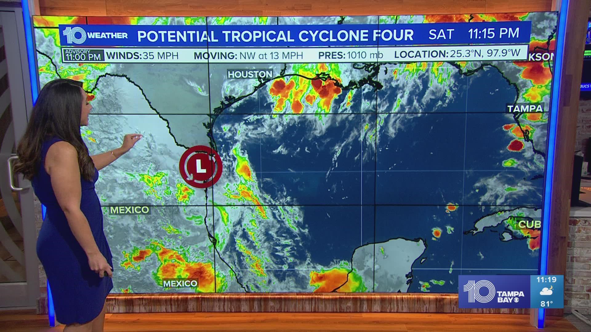
TAMPA, Fla. — A tropical disturbance is currently moving inland over the northeastern part of Mexico. It went from being labeled Invest 99-L, to Potential Tropical Cyclone Four, which allows the National Hurricane Center to issue watches and warnings for any land-mass that may see potential impacts from a developing tropical system.
The National Hurricane Center is giving PTC Four no chance for development.
Tropical Storm Warnings have been discontinued and there are no watches in effect.

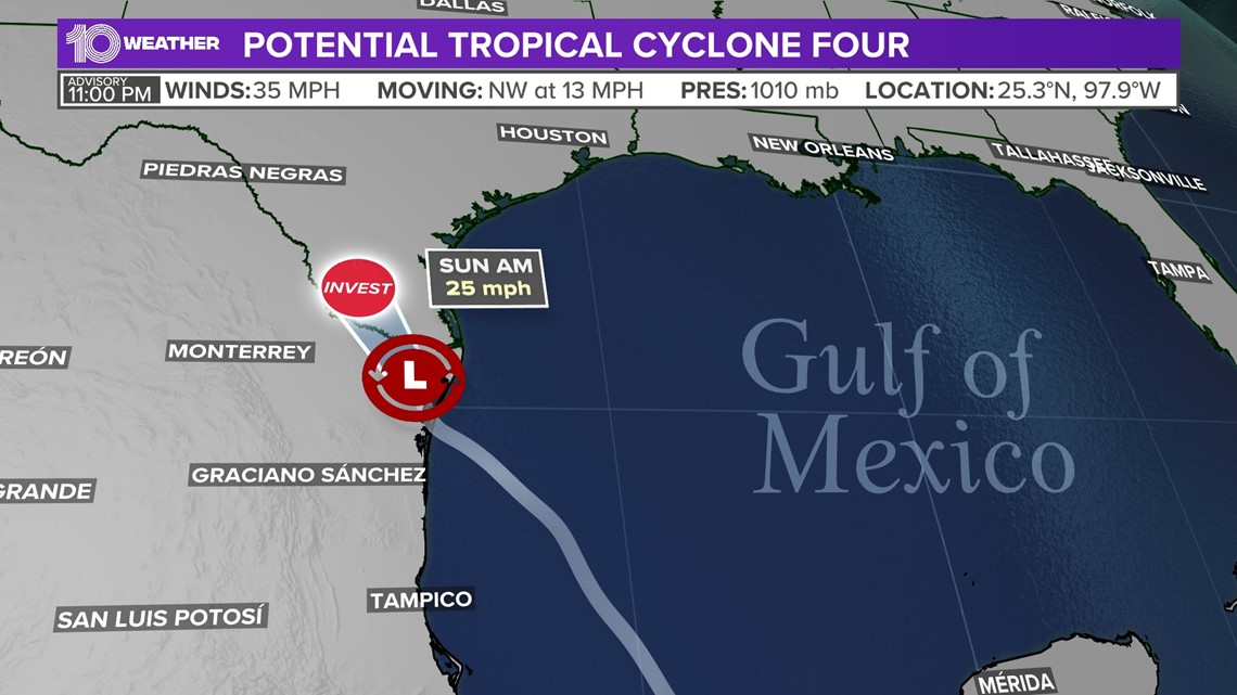
It will primarily be a rainmaker as it drifts to the northwest. Over the next 12-24 hours, it will move toward northern Mexico by Saturday night. Models keep the center of the storm south of the US/Mexico border.
Southern Texas will likely see some extra moisture from this system, giving them more beneficial rainfall through the weekend.
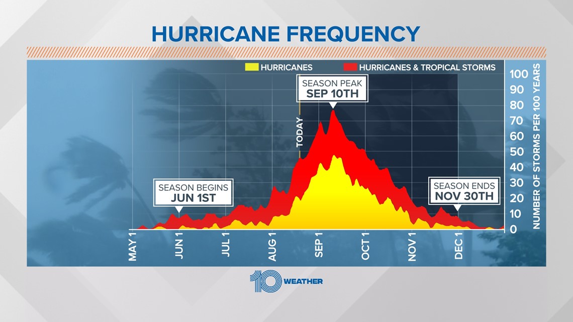
The tropics are looking to wake up toward late next week, as we work towards the climatological peak of hurricane season.
Remember two-thirds of all tropical systems develop between Aug. 20 and Oct. 10. So, the most active time of year is just starting.