
ST. PETERSBURG, Fla. — The impacts from tropical storms and hurricanes are a familiar occurrence in the Tampa Bay area and as Nicole approaches, here we go again.
Nicole's impacts will be far-reaching and are expected to begin to arrive in Tampa Bay as early as Wednesday evening.
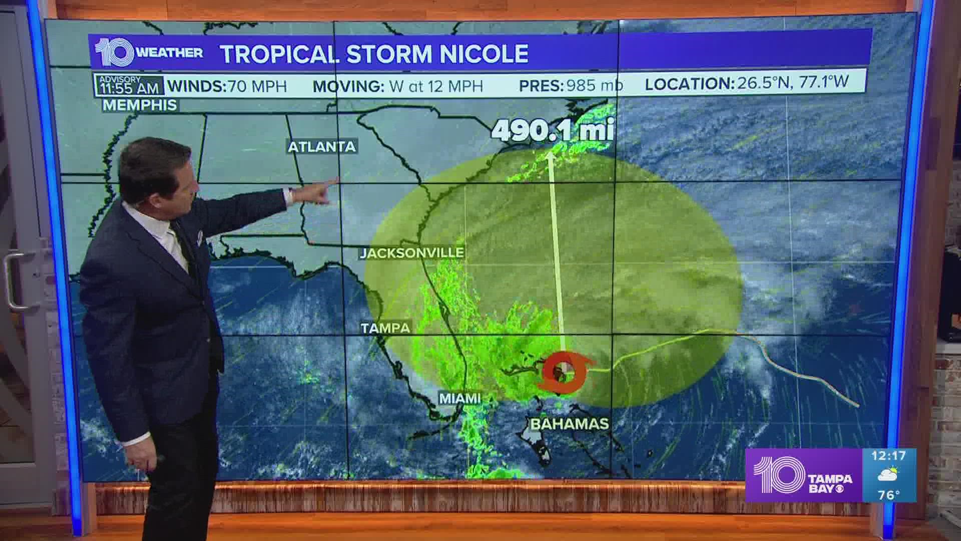
As of Wednesday morning, tropical-storm-force winds (39 mph or stronger) extended up to 460 miles from the center of Nicole as it approached the northwestern Bahamas. At this time wind gusts, along the east coast of Florida were already being observed above 40 mph.
Tampa Bay should expect breezy conditions with just a few isolated showers into Wednesday afternoon. Later this evening, the rain will become increasingly more frequent with stronger winds embedded within the arriving rain bands from Nicole.

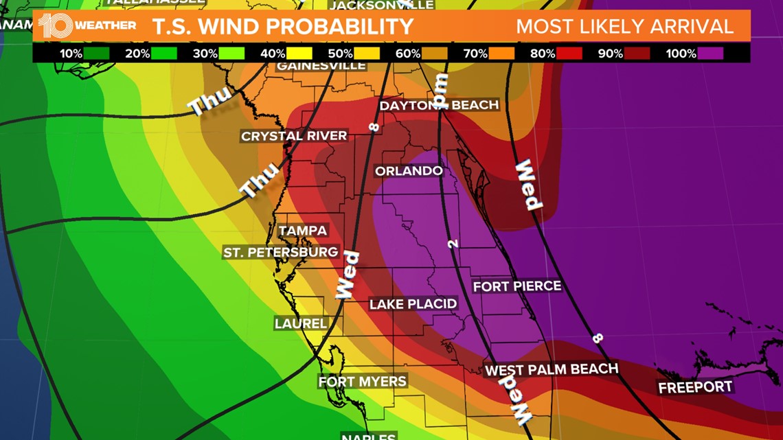
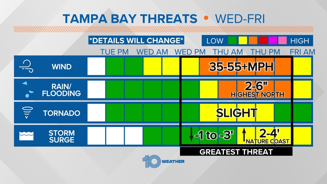
Tropical storm conditions with gusty winds and periods of heavy rain will continue across the region overnight Wednesday and through Thursday. Wind gusts could approach 45-55 mph, with some places potentially receiving close to 60 mph gusts.

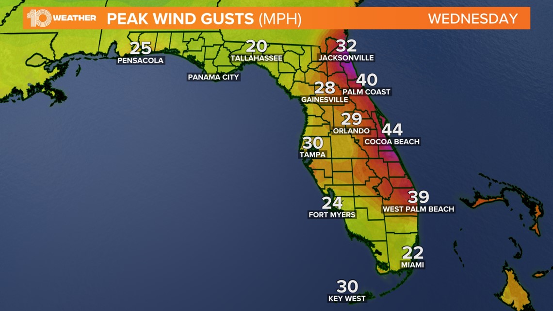
Windy conditions with intermittent stronger gusts and heavy rain could result in damage to unanchored mobile homes, porches and carports. Large broken tree limbs and shallow-rooted trees could blow down. This could all result in impassible roads and scattered power outages, especially in areas with above-ground lines.
In addition to the threat of wind damage, periods of heavy rain through the storm could result in some flooding. A general average of 2-4 inches of rain are possible, but some locations could receive upwards of 6-7 inches.
This could result in flash flooding as well as flooding in streams and rivers in the days to follow.
Initially, winds ahead of Nicole will be out of the northeast which will likely produce a period of reverse storm surge in Tampa Bay, resulting in tides running 3-4 feet below normal Wednesday night into Thursday.

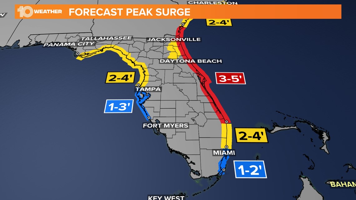
As the storm moves to the north of the region overnight Thursday into Friday morning, the winds will shift onshore and begin to produce a threat for actual surge and rising water along the coast.
Tampa Bay may experience tide levels between 1-3 feet above normal levels, but the Nature Coast from Pasco County north could experience tide levels between 4-6 feet above normal.

Through Friday afternoon, the winds will begin to relax and the associated threats from Nicole will also begin to clear out. By Friday, the sunshine will return in full force as temperatures peak around 80 degrees. Saturday night a cold front will sweep through and knock high temperatures down to 73 degrees for Sunday afternoon.