ST. PETERSBURG, Fla. — Think of a weather satellite as an “eye in the sky.” Now, give it the ultra-high-definition treatment.
That’s GOES-16 in a nutshell. The satellite launched from Florida’s Space Coast in 2016 and since has been a valuable tool in weather forecasting.
It’s way more than just a camera lens pointed at the U.S.: Just one of satellite’s six instruments provides scientists with vast amounts of data about atmosphere and then some, including cloud formation, surface temperatures, smoke, vegetative health and more.
Another instrument onboard monitors lightning strikes, which aids in the real-time forecasting of severe weather events. And when time is of the essence to provide life-saving information, scientists can receive all the satellite’s data in as quick as 30 seconds.
Check it out: Latest images from GOES-16
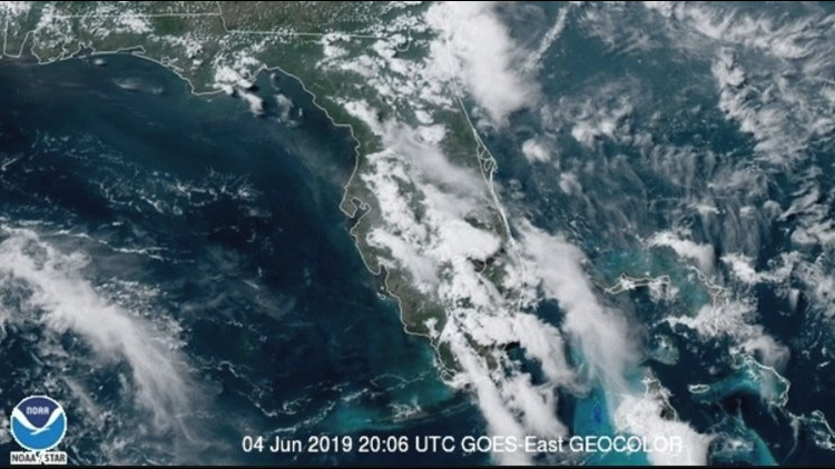
The 10News weather team has a direct connection to the satellite’s observations. You might have seen meteorologists show what they call a visible satellite image, showing where clouds are located and developing across the region.
Because the imagery is in a much greater definition than prior imagery, the team can use their weather software to zoom into a specific area and see how, say, storm clouds are building in near real-time.
GOES-16 primarily monitors the atmosphere above the eastern half of the country. Its sibling, GOES-17, monitors the West Coast and was launched into space in early 2018.
10News is your Hurricane Headquarters:
- Welcome to Florida! Here’s how to prepare for a hurricane
- Hurricane season 2019: How to check your supplies, evacuation zones, insurance coverage
- What's the difference between a hurricane watch and warning?
- New emergency rules allow for shoulder use during hurricane evacuations
- Tampa Bay most vulnerable to damage, flooding with major hurricane
►Track the weather and get severe alerts when they happen: Download
the 10 News app now.