
ST. PETERSBURG, Fla — It's about the time of year for the tropics to wake up -- and they are waking up in earnest.
The National Hurricane Center and 10Weather meteorologists are tracking not one but two areas of disturbed weather. One is a little closer to home in South Florida while the other is way out in the Atlantic Ocean.
Both, however, could play different roles in our weather moving forward.
Before we break it down, take note: Hurricane season, while starting in June, starts to see its peak in activity near mid-August into September. Now that time has arrived, and it's important to make sure you have a plan in place should a storm threaten.
Invest 98-L
This area of low pressure is not likely to develop into much of anything to start the weekend as it crosses over the Florida peninsula. Once it moves back over the east coast of Florida and over open water, weather forecasting models suggest some organization is possible.
There is a 60-percent chance of development into a tropical or subtropical depression during the next two days and a higher 80-percent chance through early next week. The hurricane center says the Air Force Reserve Hurricane Hunter aircraft could investigate the disturbance to see any signs of strengthening.
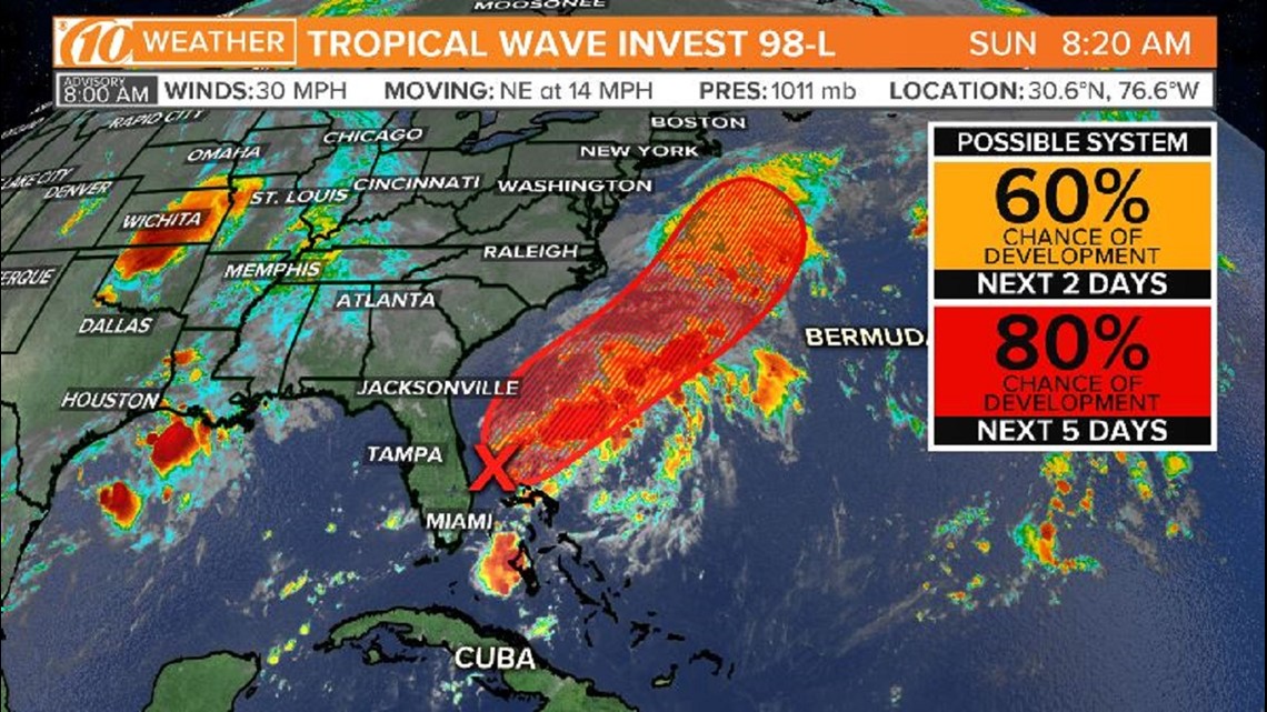
Should development occur, nearly all models have 98-L moving away from Florida and out to sea. From there, this will be a storm for the fish and any shipping interests in the Atlantic.
This system is actually pulling in some drier air aloft, higher up in the atmosphere, which could cut down on Tampa Bay's weekend rain chances. The bulk of this disturbance's rain should remain offshore.
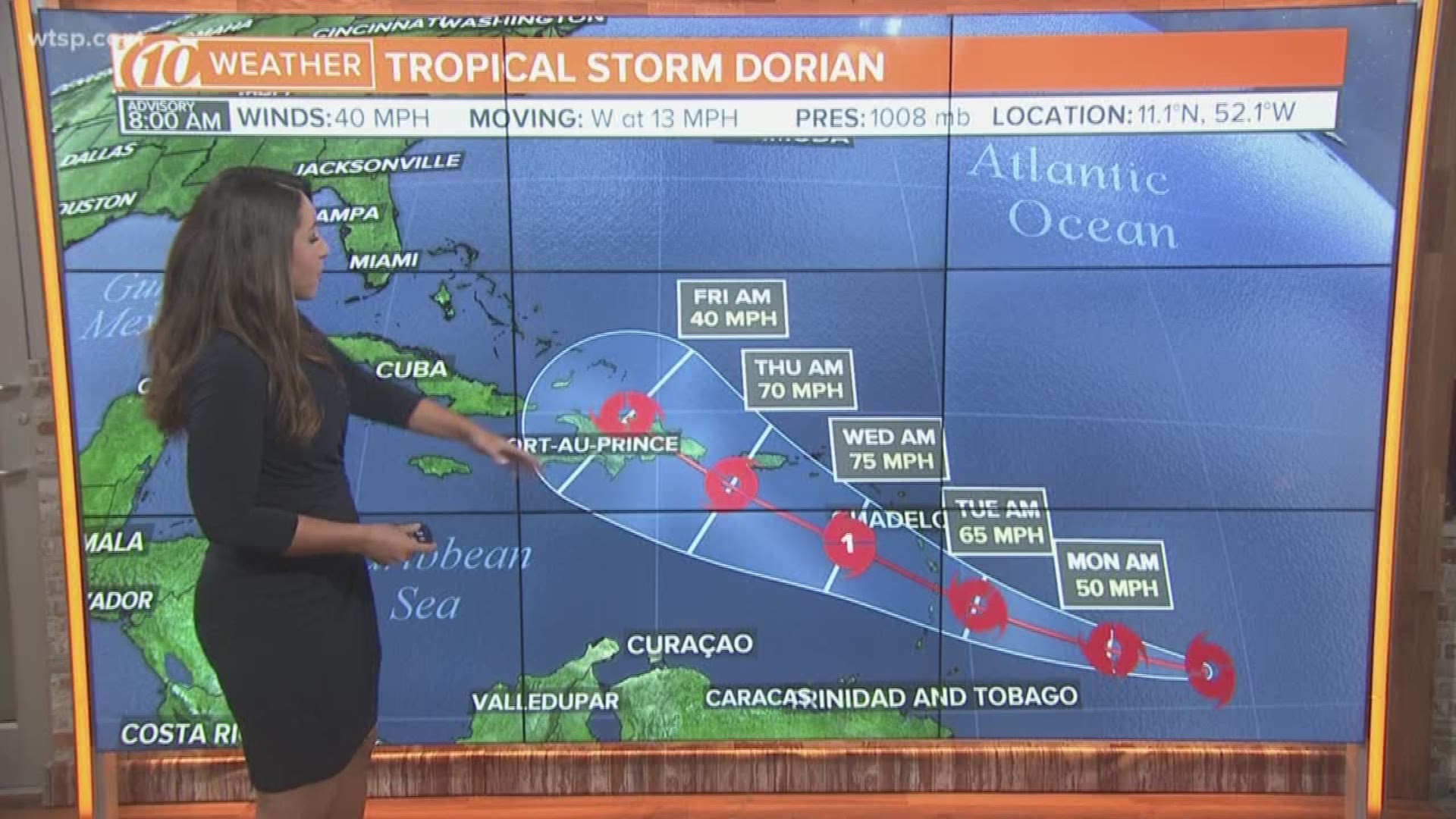
Tropical Storm Dorian
The National Hurricane Center is tracking a newly formed tropical storm in the Atlantic Ocean.
The NHC said Tropical Storm Dorian is about 555 miles east-southeast of Barbados and is moving west at about 13 mph.
Tropical Storm Dorian is forecast to continue heading westward, eventually the west-northwest, toward the Lesser Antilles. From there, any impacts to Puerto Rico, Cuba and perhaps Florida remain yet to be determined.
What other people are reading right now:
- Michael Drejka guilty of manslaughter in the shooting death of Markeis McGlockton
- Boy and mom at center of Amber Alert found dead in Texas parking garage
- Low pressure area in Atlantic could become a tropical depression this weekend
- 'We just feel so trapped': Code enforcement finds violations at luxury apartment after flooding
- Family: Newlyweds killed in accident minutes after getting married
►Make it easy to keep up-to-date with more stories like this. Download the 10News app now.
Have a news tip? Email desk@wtsp.com, or visit our Facebook page or Twitter feed.