
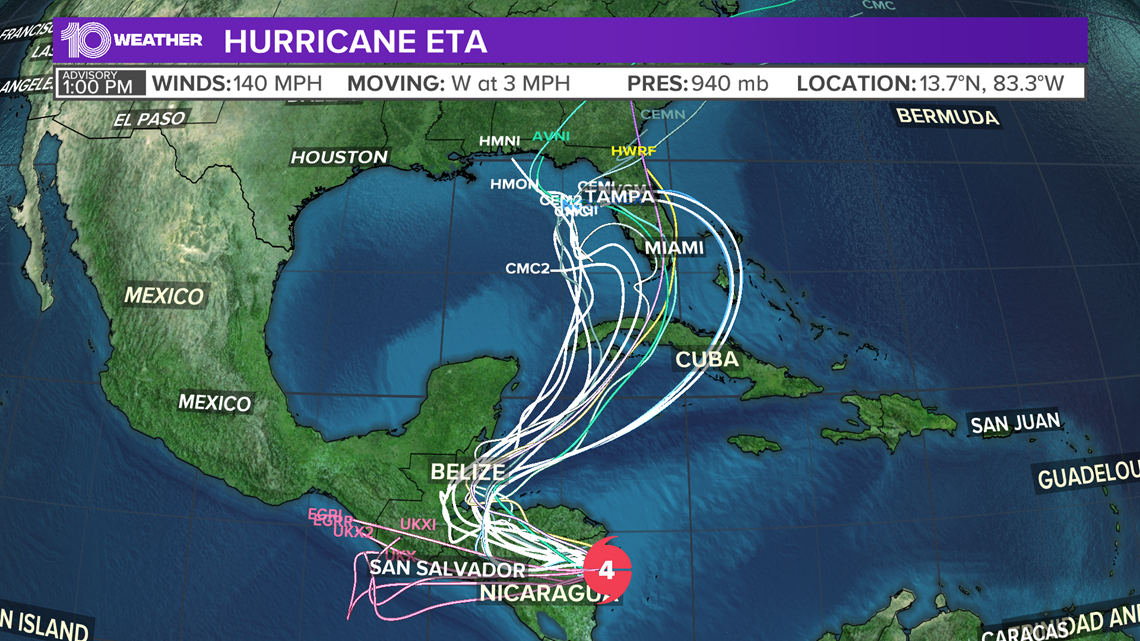
ST. PETERSBURG, Fla — Hurricane Eta is a slow-moving hurricane that experienced rapid intensification Monday. Sustained winds went from 75 mph at 4 a.m. to 150 mph by Monday evening.
Rapid intensification is an increase in the maximum sustained winds of a tropical cyclone of at least 34.5 mph in a 24-hour period.
The storm is now Category 4 hurricane strength with sustained winds of 140 mph as it moves onshore in northeast Nicaragua.

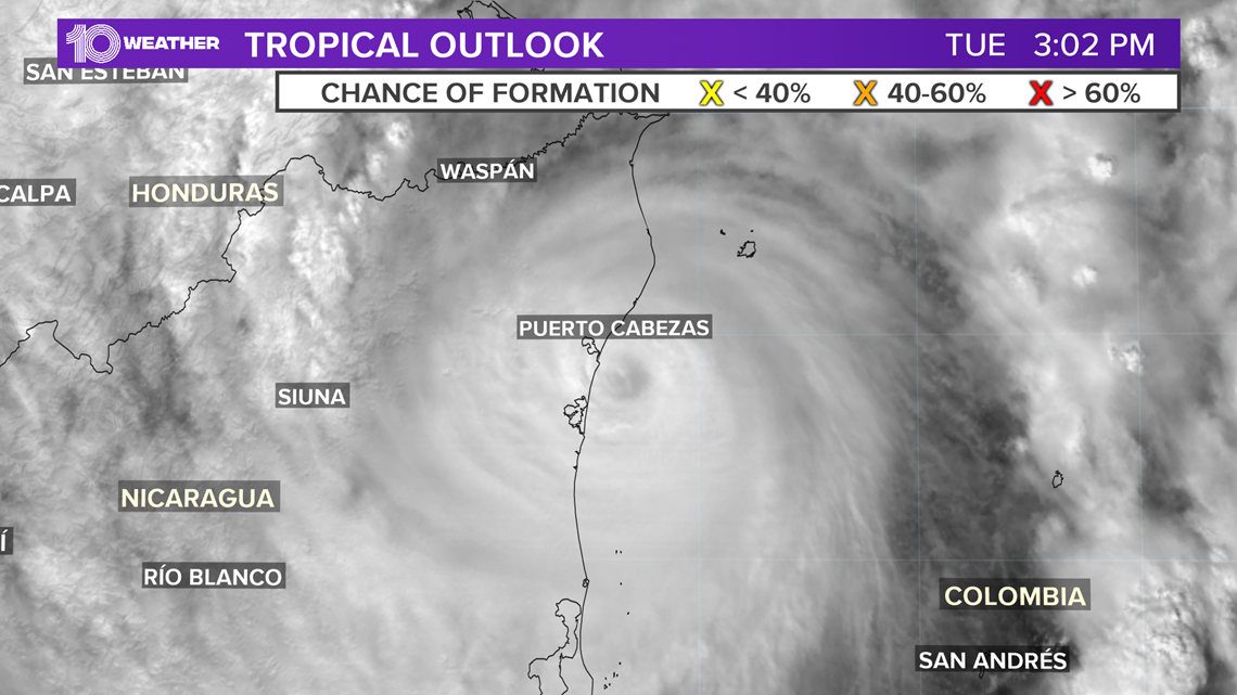
Eta will likely bring life-threatening storm surge, strong winds and nearly 3 feet of rain.
It could lead to catastrophic flooding and landslides across Central America.
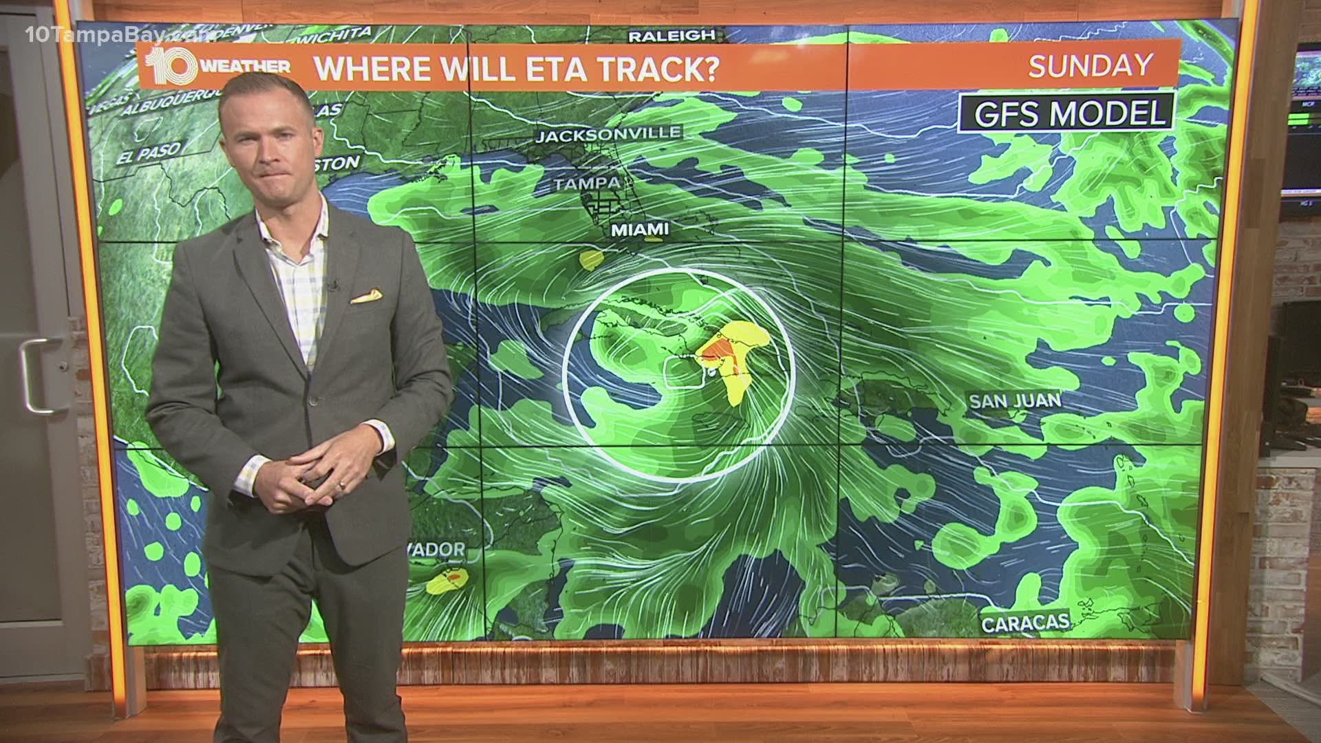
Hurricane Eta may re-emerge after landfall in Nicaragua on Tuesday. While it will weaken while over the mountainous land areas of Central America, some computer models bring it back into the Caribbean next week.
From there, some impact to Florida is possible. The latest forecast "cone of uncertainty" issued by the National Hurricane Center does include portions of South Florida. Eta could be a tropical storm by this point.

As of now, there is no threat to Tampa Bay. However, 10 Tampa Bay will be tracking the storm and keeping you updated each day.
Hurricane season is not over yet. It lasts from June 1 through Nov. 30.
10 Tampa Bay meteorologists on Facebook: Bobby Deskins, Grant Gilmore, Ric Kearbey, Natalie Ferrari, Autumn Robertson
10 Tampa Bay meteorologists on Twitter: Bobby Deskins, Grant Gilmore, Ric Kearbey, Natalie Ferrari, Autumn Robertson
►Breaking news and weather alerts: Get the free 10 Tampa Bay app
►Stay In the Know! Sign up now for the Brightside Blend Newsletter