

JACKSONVILLE, Fla. — Wildfires in the Florida Panhandle have forced 600 homes to be evacuated and at least two homes have been destroyed.
The Florida Forest Service said a very high risk of wildfires remains over the weekend due to dry weather over the past week in the region and high winds.
The fires can even be seen from space via visible satellite imagery.
This image from NASA tells a bigger story as well.
It’s the VIIRS Satellite or the Visible Infrared Imaging Radiometer Suite.

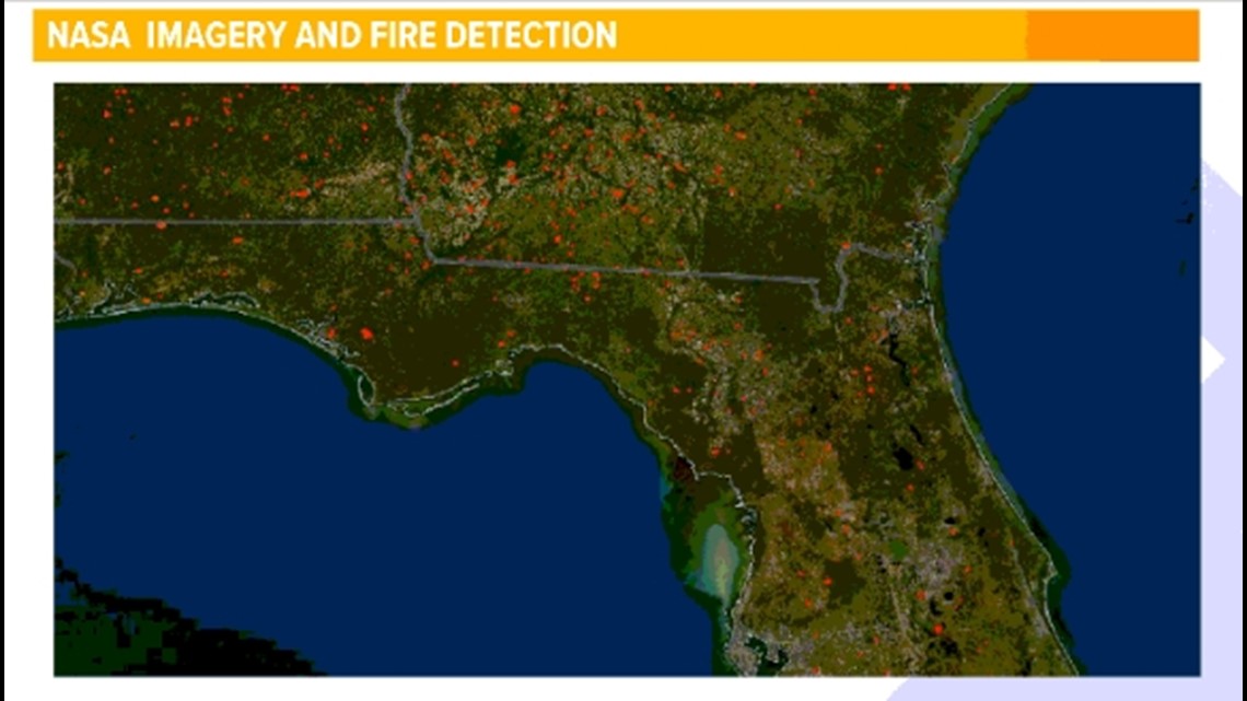
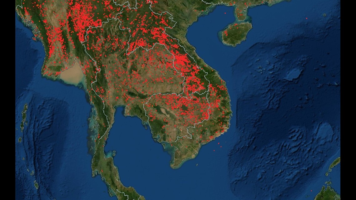
Each of the red dots are heat anomalies. Even here on the First Coast you can see a few red dots which are from controlled fires this past week.
Meanwhile, on the other side of the world fires are burning all across Cambodia as farmers clear fields to get ready for the growing season there.

This is just one more way we use satellite imagery and weather tools to gather information on our atmospheric conditions.