ST. PETERSBURG, Fla. — We know all too well in Florida that the temperature may not always line up with how cool the calendar says it should be, especially in November!
While most of the country is already dealing with frigid winter air, temperatures in the Tampa Bay region have mostly been running near or slightly above normal for this time of year.
But some big changes are on the way!
We're tracking our next big cold front that is slated to arrive in Florida by the middle of this week, and the cooler air behind it will actually stick around through the second half of the week.

As early as Tuesday night, we'll already see some rain sweep across northern Florida. This will be moisture squeezing ahead of an approaching cold front. We expect this to arrive in central Florida overnight through early Wednesday.
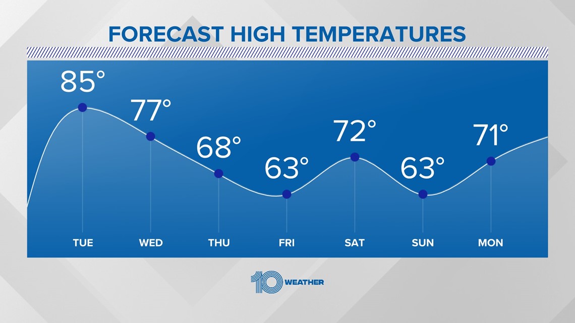
Wednesday morning will bring a 20 to 30 percent chance for brief showers to sweep through, then the front pushes in behind shortly after. Since Wednesday will be a day of cooling, we'll still make it into the 70s.
Then cooler and drier air arrives Thursday, with lows in the 50s and daytime highs only making it in the middle 60s.
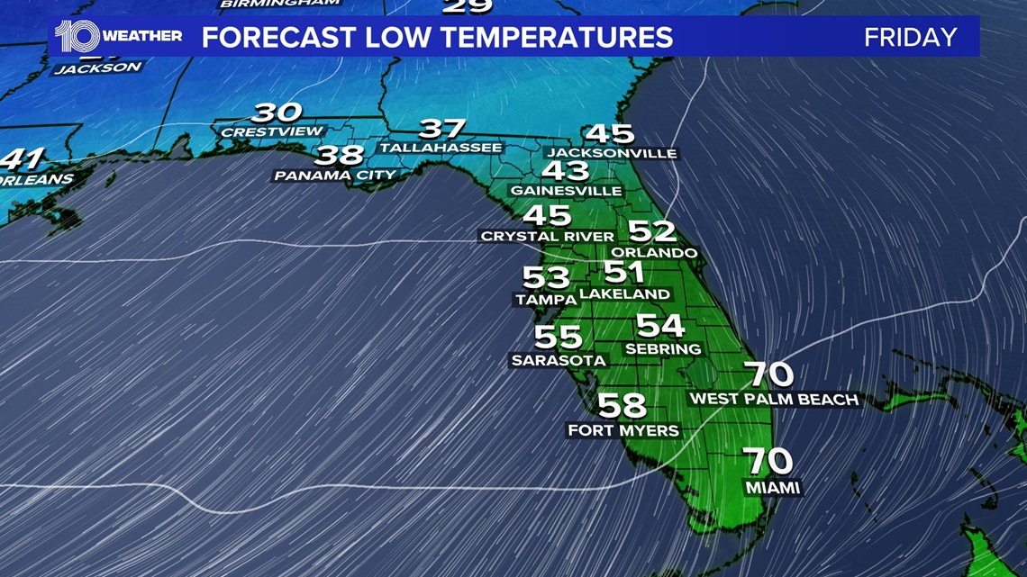
This front is expected to slow down and stall to our south. As it does so, we could see some extra clouds stick around by Friday, keeping our already cooler air overhead locked in place. Some spots, especially along the Nature Coast, will struggle to even climb out of the 40s Friday morning! Daytime highs will likely struggle to climb back to 70 degrees by the afternoon, depending on the amount of cloud cover.

While temperatures will try to sneak their way back into the 70s by Saturday, an area of low pressure to our west looks to be setting up over the weekend across the southern U.S., approaching the state by Sunday, bringing more clouds and rain chances our way. This combined with a stalled boundary to our south would also keep our temperatures down as we wrap up the weekend and go into next week.