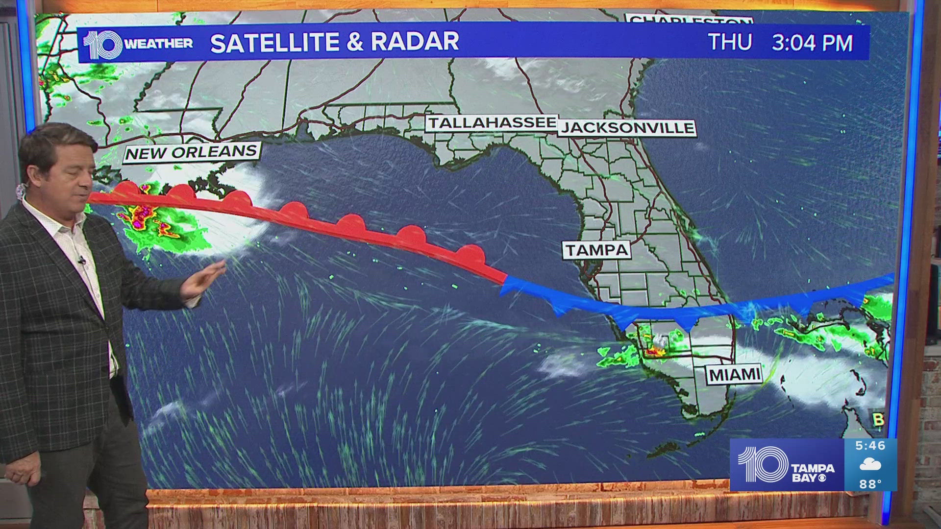
ST. PETERSBURG, Fla. — Our frontal boundary pushed south and stalled out over far SWFL bringing rain and storms to the Fort Myers area. This leaves Tampa Bay in the clear, with drier air filtering in allowing for a brief break in the humidity!
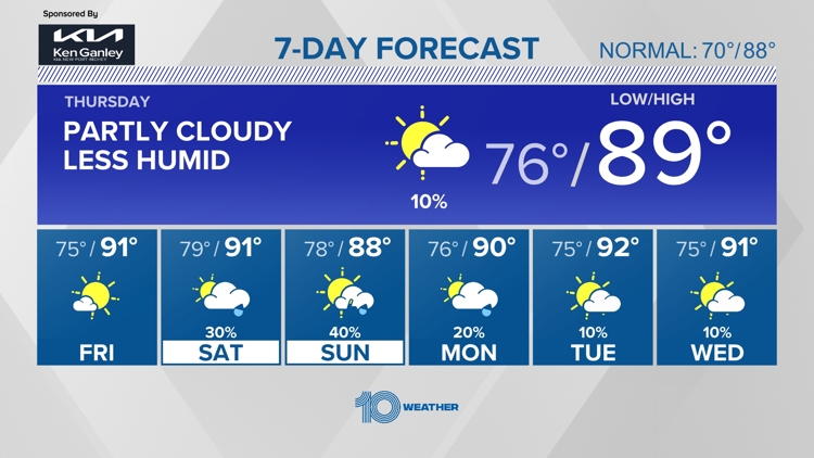
Thursday and Friday: Conditions become slightly more humid but rain chances stay away as temperatures climb back near 90 degrees under a great mix of sun and clouds.
Saturday: Partly cloudy, high of 93 and a 30% chance of rain
Sunday: Scattered showers and mostly cloudy, high of 89 and a 40-50% chance of rain
For more weather updates and information download the free 10 Tampa Bay app to your device.
10 Tampa Bay meteorologists on Facebook: Bobby Deskins, Natalie Ferrari, Amanda Pappas, Mike Prangley, Colleen Campbell
10 Tampa Bay meteorologists on X: Bobby Deskins, Natalie Ferrari, Amanda Pappas, Mike Prangley, Colleen Campbell