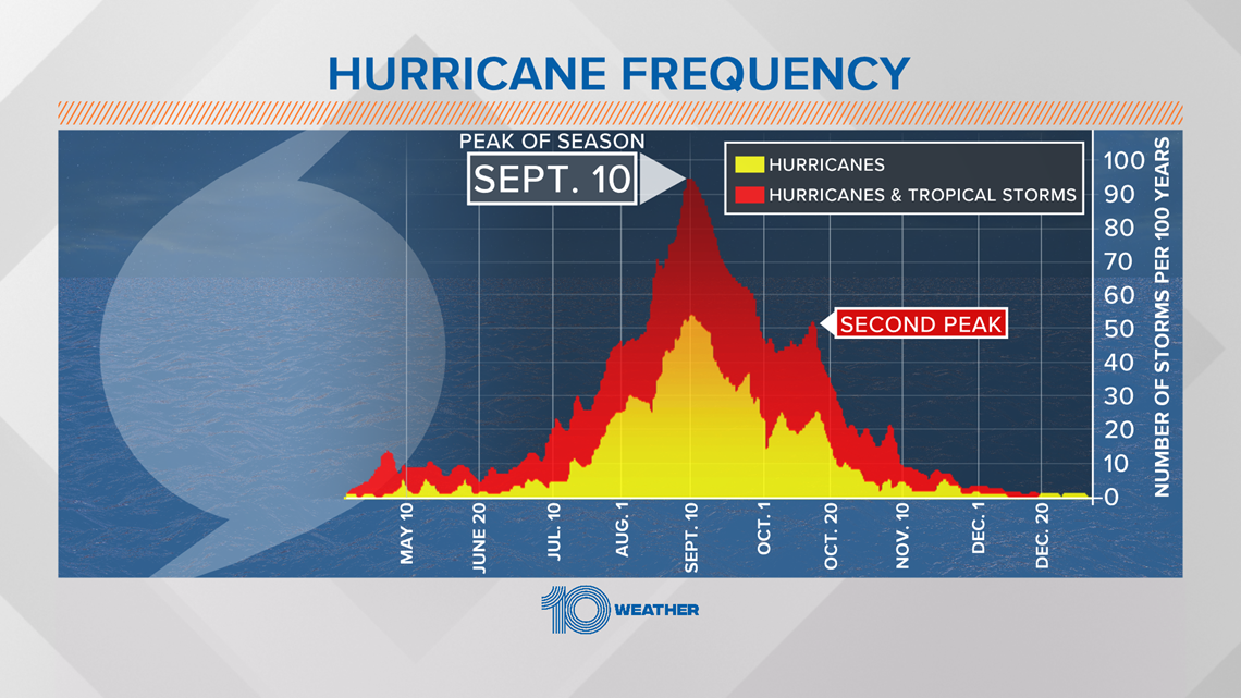
While the hurricane season statistically peaks in mid-September, October is an important time for tropical cyclone development in the Gulf of Mexico and the Caribbean.
October is a time the water temperatures in the Atlantic Ocean typically start to cool and wind shear increases, so the majority of the tropical activity shifts back into the Caribbean Sea and Gulf of Mexico, where water temperatures are usually still very warm.


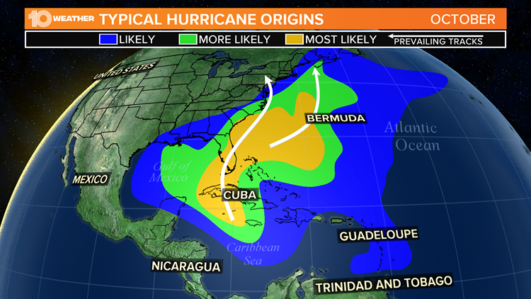
The map above shows the prevailing tracks that these storms take for the month of October. Most form in the Caribbean Sea or Gulf of Mexico and move north and then northeastward. Depending on the exact circumstances, this setup can often bring storms close to the Florida peninsula.
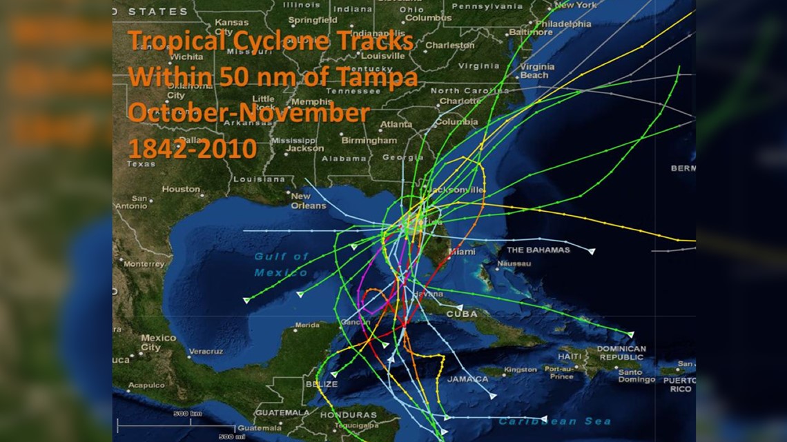
The image below from the National Weather Service shows the tracks of all tropical cyclones that made landfall within 50 nautical miles of Tampa through 2010 for the months of October and November. There are a total of 17 storms, and all but a few originated in the Caribbean Sea or Gulf of Mexico.

The National Hurricane Center is expecting no tropical development over the next 5 days, meaning the rest of September should be relatively quiet.
However, October usually brings a second peak to hurricane season, mainly for the Gulf of Mexico and the Caribbean before the activity starts to diminish greatly in November.

What other people are reading right now:
- Sheriff: Pilot killed in plane crash near Inverness Airport
- Another 203 people in Florida have died from COVID-19
- Lightning look to take Stanley Cup Final lead in Game 3
- Middle school teacher arrested, accused of sending explicit messages to 13-year-old
- Family of Don Lewis sues Carole Baskin for defamation
- NFL: 'We’re hopeful we can fill the stands' for Super Bowl LV in Tampa
- Results of climate change: Warmer world, stronger storms
►Breaking news and weather alerts: Get the free 10 Tampa Bay app
►Stay In the Know! Sign up now for the Brightside Blend Newsletter