
ST. PETERSBURG, Fla. — If an evacuation order is issued for your area or storm surge is threatening to flood the Tampa Bay region, do you know which zone you're inside and where you're supposed to go?
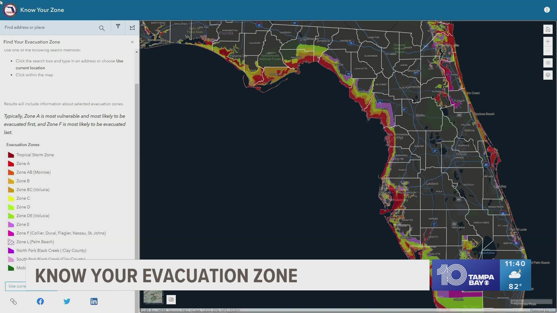
The Florida Division of Emergency Management has a map for each county posted on its website, showing generalized evacuation zones and accessible routes.
Remember, these maps are posted as a reference. Any specific evacuation order is issued by local emergency managers.
The two biggest evacuation routes, if necessary, are Interstate 75 north to the Georgia state line and I-4 east into Orlando. In some extreme evacuation situations, the highways will go into "contraflow," meaning traffic in all lanes moves in the same direction.
Evacuation Zone Maps
Storm surge is historically the most dangerous aspect of a major hurricane. A storm's strong winds can cause water from the ocean to crash against an area's shoreline, causing water levels to increase by 30 feet in major storms and bring about inland flooding.
"You are taking the ocean and raising it," storm surge expert Hal Needham, the director of Marine Weather and Climate in Miami, told The Associated Press. "It’s not a wave the surfer rides. It’s actually raising the ocean. That’s why it’s so scary."
The following maps show which parts of a county could potentially be flooded with storm surge.