
ST. PETERSBURG, Fla. — Originating more than 4,000 miles across the Atlantic Ocean, the hazy skies that have been seen over Tampa Bay this week are a result of yet another plume of Saharan dust.
These plumes of Saharan dust are quite common from late June into August and even got a bit of an early start this year with our first notable plume hitting the Florida coast back in May.
During the peak Saharan dust season from late June to mid-August, the plumes of dust typically emerge from the coast of Africa every three to five days. Not all plumes, however, are robust enough to make their way all the way to the United States.
While the majority of the dust associated with these plumes is concentrated well above the ground, sometimes the dusty particles can reach down to the surface.
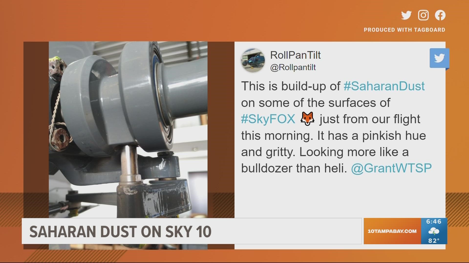
In fact, the current plume of dust was strong enough that the pilots of the Sky 10 helicopter noticed accumulated dust/sand on portions of the body of the helicopter after flying in the hazy sky Wednesday.
In these situations, air quality will be reduced potentially posing a threat to those with respiratory issues. It’s important to stay aware of the air quality on days when these Saharan dust plumes move into the area.
Symptoms that you might experience may be similar to those resembling allergies, such as scratchy throat, itchy eyes, sneezing or coughing.
Warm and dry air is also associated with these plumes of Saharan dust and often times areas experience their hottest days of the year when these plumes are present. In addition to the potential for poor air quality, it’s also important to be mindful of the dangers of excessive heat, especially through the middle of the afternoon.
The current plume of dust is expected to begin to move out Thursday night into Friday, allowing a little more moisture to build in for the weekend, increasing rain chances once again.
The good news, however, is the Saharan dust over the Atlantic has been a big part of why the tropics have been relatively quiet recently. Saharan dust and tropical systems do not mix. The thick dust can help to cool sea surface temperatures down slightly, and the dry air and strong winds can help inhibit tropical cyclone development and/or intensification, at least temporarily.
When tropical systems ingest dry air and encounter wind shear, they tend to struggle and lose their structure. These dry, strong winds associated with the Saharan Air Layer reduce the moisture needed for tropical storms and hurricanes to form, which can limit their organization.