ST. PETERSBURG, Fla. — The weekend is going to be soggy with the potential for severe storms and coastal flooding across the Tampa Bay area.
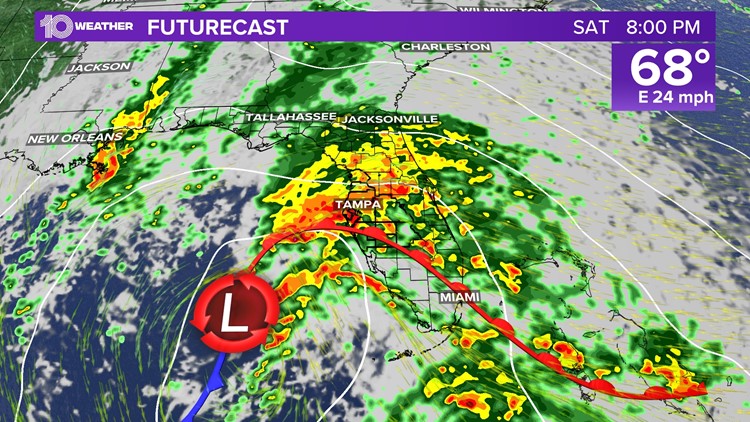
As the system we've been tracking all week in the Gulf finally arrives Saturday morning, the rain begins. A storm system will move onshore near Tampa, which will bring us strong to potentially severe storms this weekend.
The severe weather potential includes isolated tornadoes, gusty winds, lightning and flooding — all starting Saturday afternoon through overnight Sunday. The forecast indicates that is when the majority of the severe weather threat will happen.
The 10 Weather team is here to keep you informed, prepared and connected through any severe weather. Download our free 10 Tampa Bay app to get the latest live radar and storm coverage.
Here's the breakdown of what you need to know this weekend:
Florida's storm timing
As early as 9 a.m. Saturday, expect areas of scattered rain and gusty winds. Bottom line — if you want to avoid heavy downpours and worsening weather conditions, finish any outdoor activities or travel in the morning and be ready to move indoors.
Around the midafternoon hours Saturday, the threat of severe storms begins. The low-pressure system begins to approach Florida's West Coast, and we see our first strong bands of wind and rain move through.
Then around 8 p.m. Saturday through the overnight hours, the system will push onshore bringing us the greatest potential for isolated tornadoes and severe weather. Sunday morning into the afternoon, the storm system leaves our area. In terms of rainfall, we'll see major improvements and start drying out by noon Sunday.
By Monday morning, we finally return to normal with partly cloudy to mostly sunny skies.


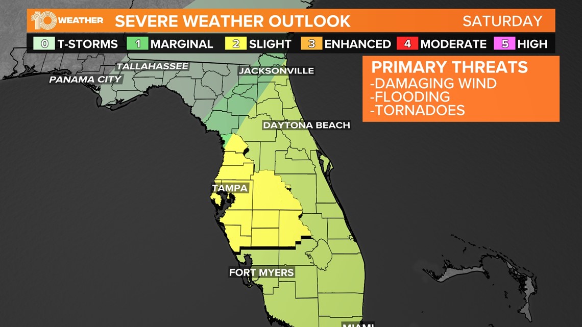
Severe weather and flooding impacts
There is a level two out of five risk for severe weather for most of the Tampa Bay area. Areas leading to the Nature Coast are at a level one, or marginal risk.
The main impacts will be gusty winds between 35-45 mph and isolated tornadoes. Additionally, between 2-3 inches of expected rain could lead to flooding and lightning. Coastal flooding is likely on Sunday.

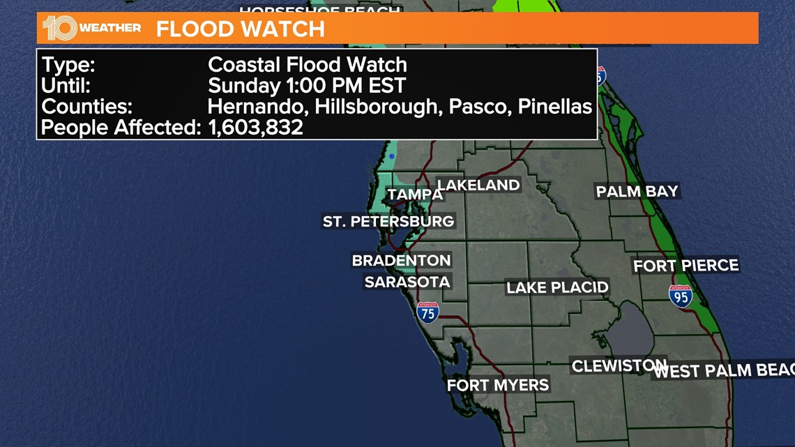
Tampa Bay-area coastal flooding
Tides will generally be 2-3 feet above normal and the entire state of Florida can expect some flooding and abundant amounts of rainfall this weekend. As our wind pattern shifts on Sunday, coastal flooding will be an issue.
In anticipation of flooding, a coastal flood advisory is in effect from 7 p.m. Saturday through 7 a.m. Sunday from Citrus County southward to Manatee County. Minor coastal flooding is expected, with the flooding of lots, parks and roads possible.
It won't be a good day to get into the Gulf, with large waves up to 6 feet possible.
Here's a breakdown of water levels above normal high tides:
- Nature Coast: 2-4 feet
- Tampa Bay: 2-3 feet
- Southwest Florida: 1-2 feet