ST. PETERSBURG, Fla. — An area of showers and thunderstorms will move into the Tampa Bay area late Tuesday into Wednesday, bringing a small chance of hail and damaging winds.
The day will begin mild and muggy ahead of an approaching cold front. Some locations could see a few pop-up showers before the main activity arrives after sunset.
The Storm Prediction Center has highlighted all of the Tampa Bay area under a marginal risk for severe weather — a risk level of one out of five — given a chance of isolated hail and strong winds.
You'll want to download the free 10 Tampa Bay app to get breaking news and weather alerts as they happen.
This evening
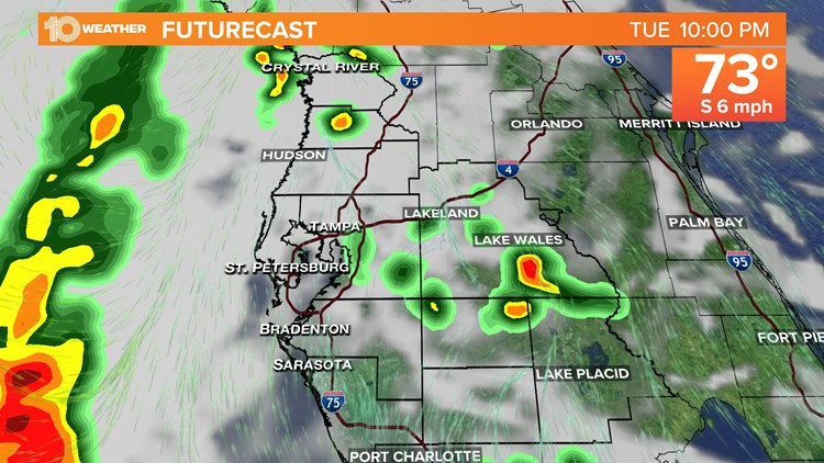
The later hours will be relatively calm with a few showers, but that changes after 9-10 p.m. A line of heavy downpours and a few strong storms will move in from the Gulf of Mexico and push east into our inland zones.

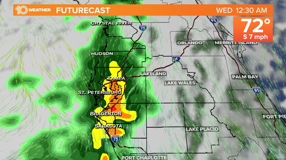
Overnight
Coastal zones can expect storms and rumbles of thunder from 10 p.m. to 1 a.m. Inland zones will see rain and storms from midnight to 5 a.m. Aside from a small risk of severe weather, expect frequent lightning and gusty winds up to 30 mph.
Looking toward Wednesday
Later Wednesday morning, winds will gust to 20-25 mph with lingering rain, but most of the storm activity will shift toward Florida's east coast.
By the afternoon, there's still a chance for a few showers, but skies will gradually clear, especially toward evening. Temperatures still will be mild, however, expect a drop in humidity.