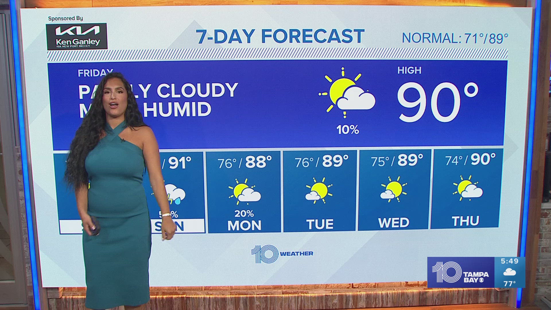
ST. PETERSBURG, Fla. — Our weather pattern may have felt pretty stagnant and rather warm for December, but that winter-like chill is on the way!
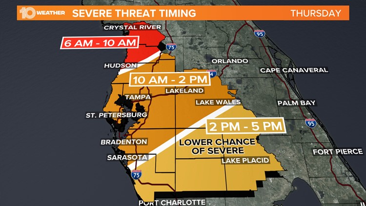
Before we talk temperature drop, we must address the rain and storms that will push ahead of our next big cold front. Our next best chance rain in the Tampa Bay area arrives on Thursday.
This next shift in our weather pattern is actually associated with a winter storm that has been traversing across the U.S. this week. Once that cold front arrives, we are looking for a good 80-90% chance of rain and even some thunderstorms.
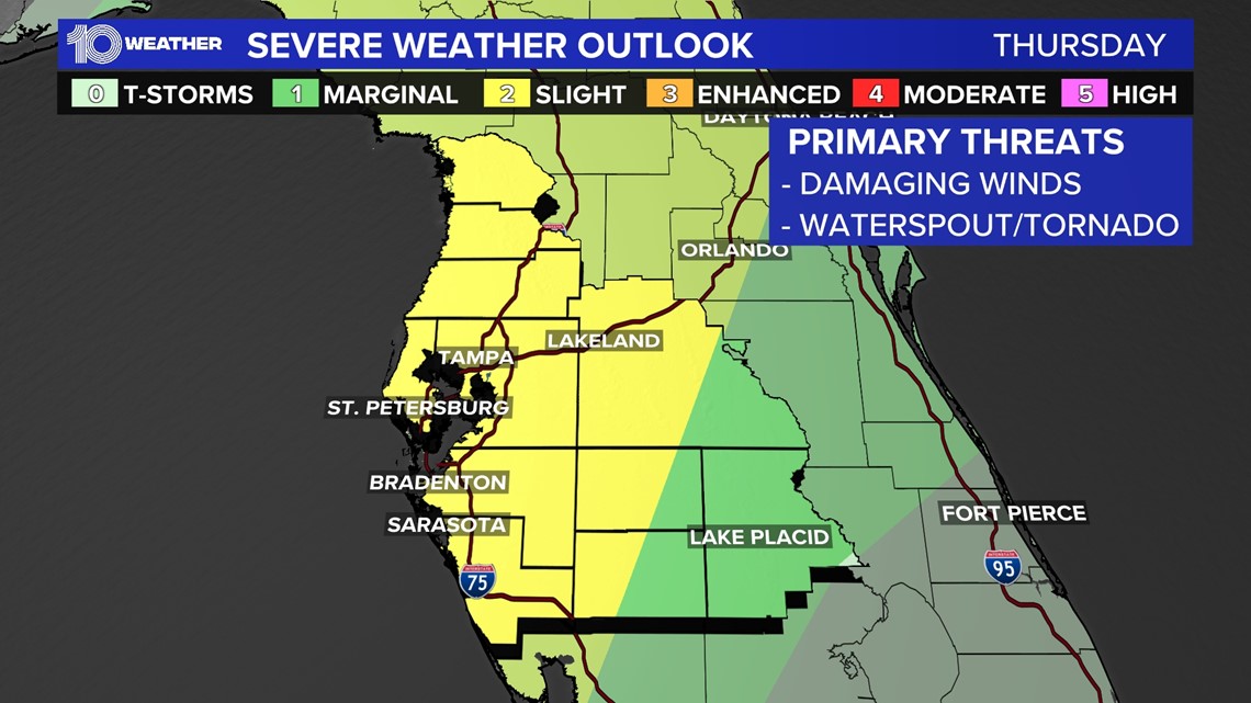
Severe threat
According to the Storm Prediction Center, much of the Tampa Bay region is in a SLIGHT risk (2 on a scale of 0-5) for severe weather. This means that some storms may quickly turn severe, but the overall coverage will be isolated and short-lived.

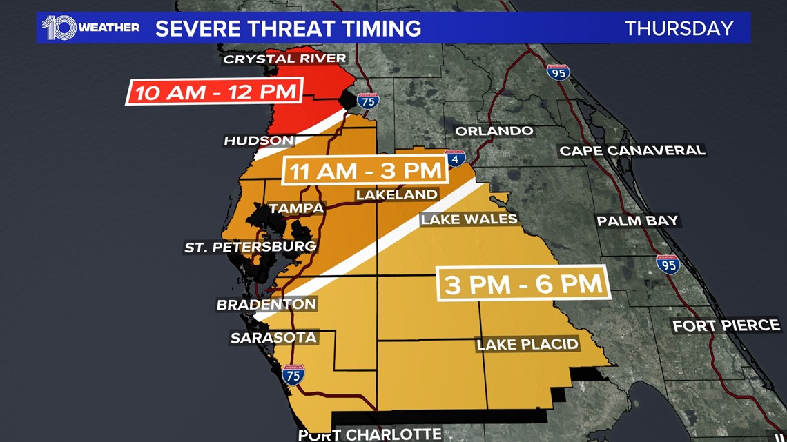
While there may be just enough lift to support some strong to severe storms as the system moves through the Florida West Coast, the overall threat will actually diminish from north to south throughout the day Thursday. The timing could have the best chance of rain and even some strong storms in counties north of Tampa Bay Thursday morning, then drifting south of Tampa Bay in the afternoon, as the severe weather threat decreases.

Chilly air arrives...and stays
Once the front pushes through the area, cooler air will start to filter in behind it, bringing down our temperatures. Dew points will also drop considerably once the front has passed, meaning you will really feel that drier air take over the region!

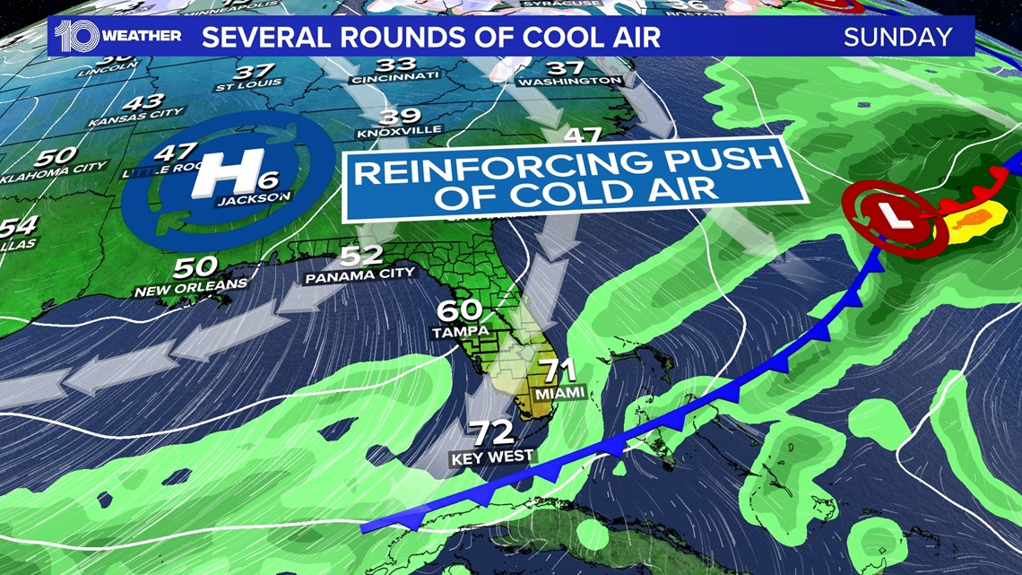
Thanks to this big cold front, cooler, drier, and breezier conditions really dive in and look to stick around even into the weekend, with the coldest day likely being Sunday as daytime high temperatures only make it into the middle 60s and lows plummet in the 40s through early Monday morning.

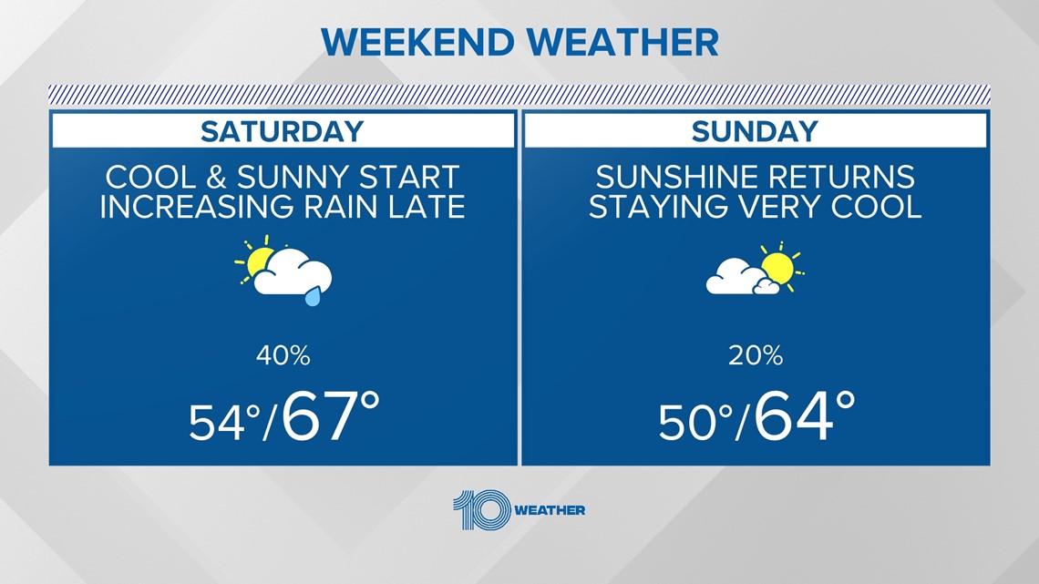
Expect below-normal temperatures, both highs and lows, to stick around through early next week.
As we kick off next week, a nice gradual warmup is expected and easterly winds return and conditions become slightly milder. Between now and then though, break out the sweaters and boots!