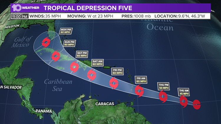
ST. PETERSBURG, Fla. — Tropical Depression Five has officially formed in the Atlantic, according to the National Hurricane Center (NHC).
And, it could become Tropical Storm Elsa. So far the southern half of central Florida is included in the "cone of uncertainty."
With this latest advisory, tropical storm warnings have been issued for Barbados, Martinique and St. Lucia. A tropical storm watch is in effect for St. Vincent and the Grenadines and Guadeloupe.
Earlier Wednesday, Invest 97-L was given the designation of "potential tropical cyclone."
A potential tropical cyclone is a disturbance that is not yet a tropical cyclone, but which poses the threat of bringing tropical storm or hurricane conditions to land areas within 48 hours.
The phrase “potential tropical cyclone” is actually relatively new terminology from the NHC. It was created in 2017 to identify areas of disturbed weather close to land that are expected to become tropical cyclones.
A tropical cyclone is either a depression, storm or hurricane with a well-defined center of circulation at the surface. If winds hit at least 39 mph, it becomes a tropical storm. Once winds hit at least 74 mph, it becomes a hurricane.

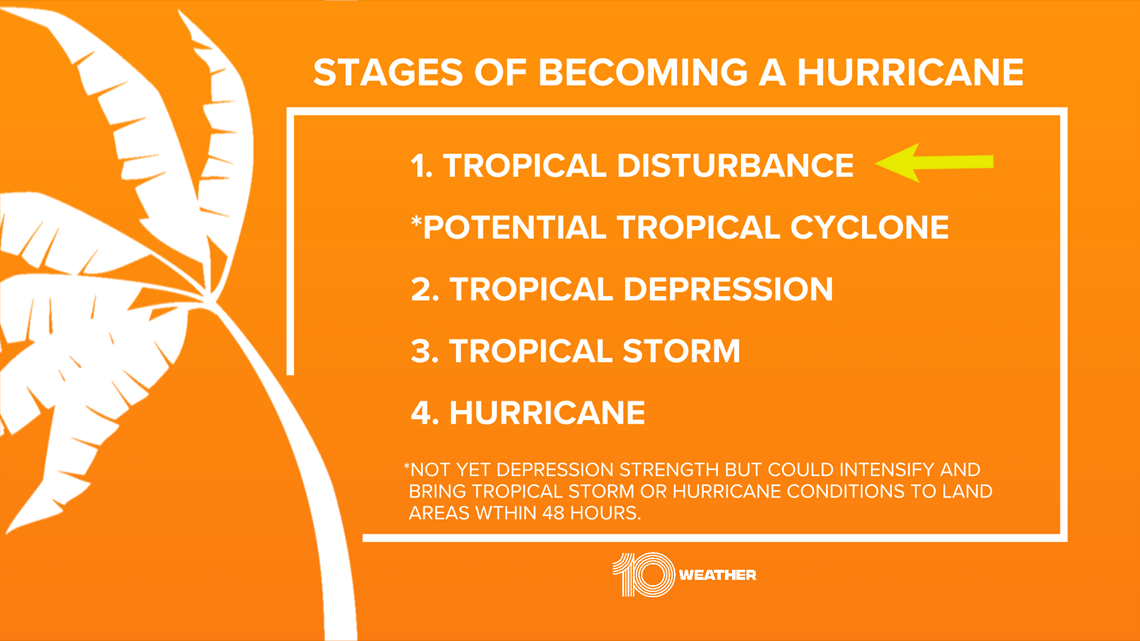
Once a storm is labeled at least a potential tropical cyclone, advisories can be issued, even though it has yet to develop fully into a tropical cyclone.
Essentially, potential tropical cyclones are treated like tropical depressions, named storms and hurricanes, even though they haven't officially developed.
So what’s next with Tropical Depression Five? It will likely become Tropical Storm Elsa. Once the cyclone fully develops and maximum winds hit at least 39 mph, it will become a tropical storm. Elsa is the next name on the 2021 hurricane list.

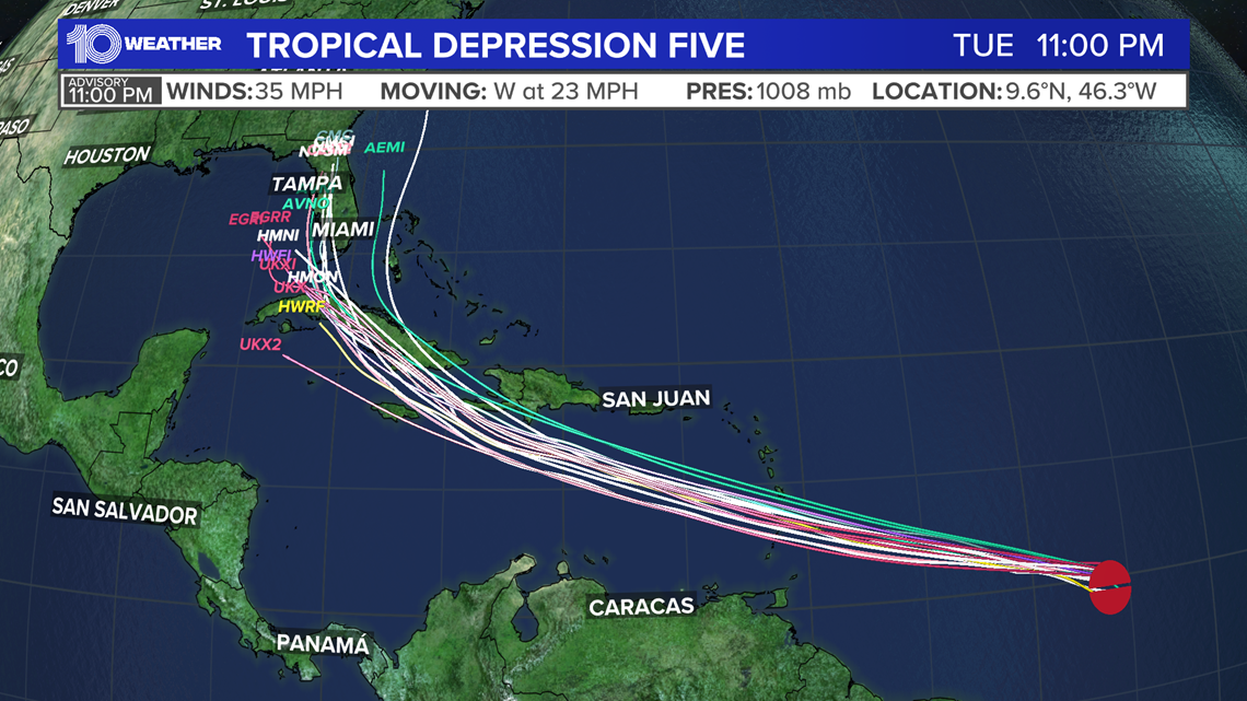
Models vary on how much this system develops as it tracks across the Caribbean. Some forecast models strengthen the system and track it toward Hispaniola and Cuba, while other forecast models weaken and dissipate the system altogether.
As far as potential Florida impacts, it's still too early as the track and intensity of the potential tropical cyclone is still uncertain. If it survives its track through the Caribbean, it could potentially get into the Gulf of Mexico early next week.
The team of meteorologists at 10 Tampa Bay will keep you posted online and on television as this system develops in the coming days.
Peak hurricane season runs from August through early October when the ocean waters are typically at their warmest. Hurricane season ends on November 30.
Learn more about preparing for hurricane season at the 10 Tampa Bay Hurricane Headquarters.
- Severe weather may stretch resources in Florida condo search
- Number of dead in Surfside condo building collapse rises to 12
- Tampa Bay Lightning hope to continue their winning streak in Game 2
- Miami Herald: Contractor noticed damage underneath pool deck at Surfside condo just before collapse
- A Frank Conversation: New podcast explores race, religion, politics and more
►Breaking news and weather alerts: Get the free 10 Tampa Bay app
►Stay In the Know! Sign up now for the Brightside Blend Newsletter