ST. PETERSBURG, Fla. -- We're closely watching Invest 98L, could head to the East Coast.
Download the 10News app for breaking weather alerts on the system.
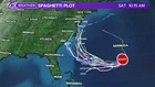
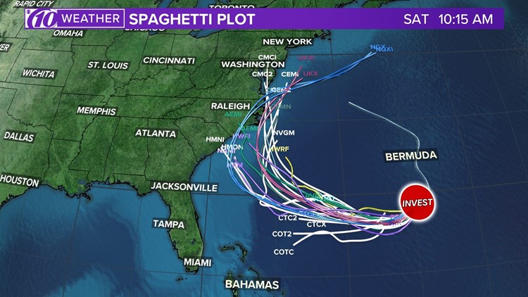
Spaghetti models
Each line represents a computer model's best "guess" of where the center of the storm will go. Together, they look like "spaghetti." Remember, impacts from a tropical system can and do occur miles away from the center.
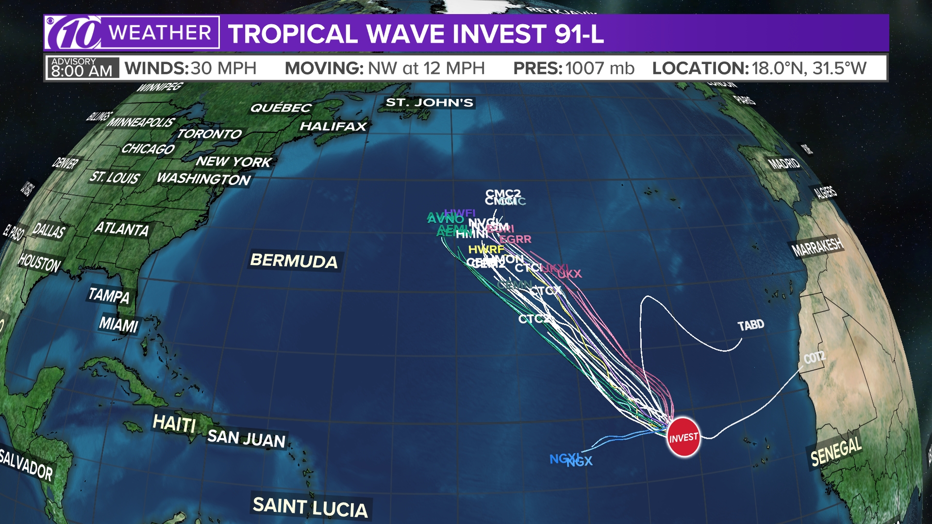
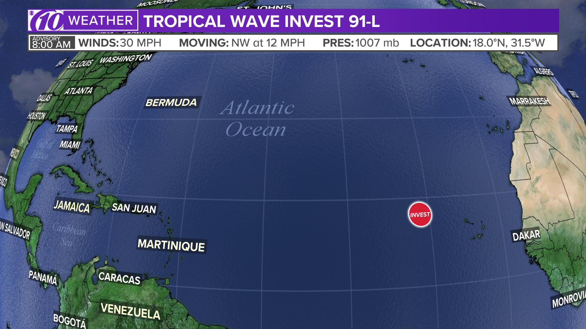
Current position
This is the latest position, which shows the center of the storm.
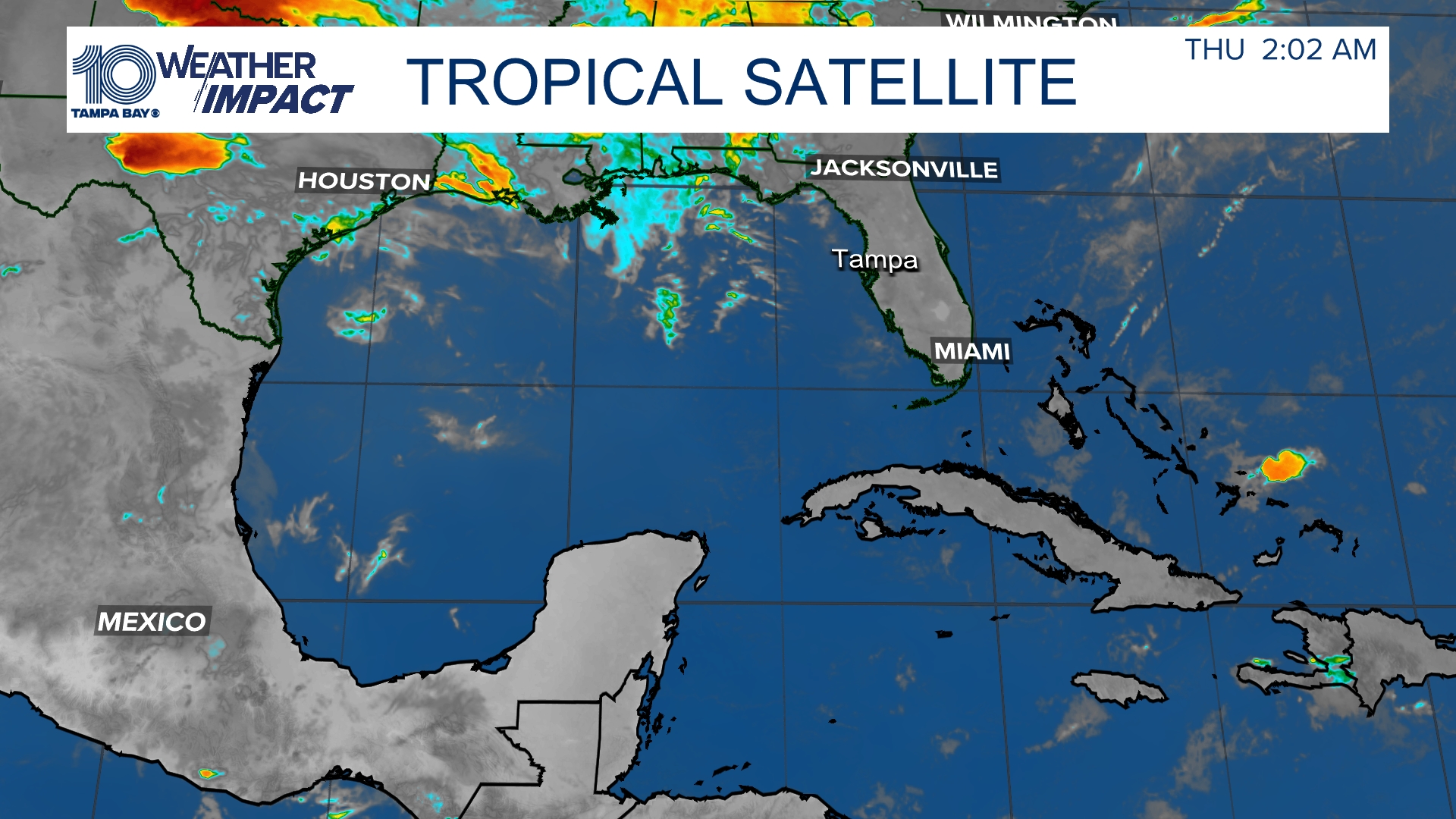
Satellite and radar
The latest satellite and radar image for the Gulf of Mexico, Caribbean Sea and Atlantic Ocean.
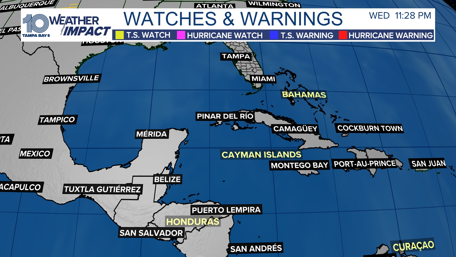
Watches and warnings
What's a watch? What's a warning? Here are the official alerts that can be issued for your area and what you should do.
►Make it easy to keep up-to-date with more stories like this. Download the 10News app now.
Have a news tip? Email desk@wtsp.com, or visit our Facebook page or Twitter feed.