
ST. PETERSBURG, Fla. -- Hurricane season's last "hurrah" of sorts comes toward mid-to-late October, so perhaps it's only normal to be watching an area of showers and thunderstorms in the Caribbean.
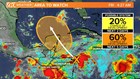
It's early -- very early! -- to definitively say what will come from this area of disturbed weather. The National Hurricane Center gives it a very low, 20-percent chance of developing into any sort of tropical system during the next couple of days.
The odds increase to 60 percent of something developing through early Tuesday.
Why the early heads up?
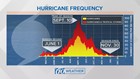
Although we are well past the halfway point of hurricane season, there's been a bit of a bump in activity toward the end of October. Look at this frequency graph below -- you can see the slight uptick:

Stay informed: Download the 10News app for breaking news and weather updates from the 10Weather team
Be prepared: Check your supplies, evacuation zone and more
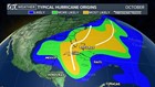
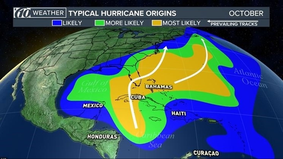
There's also the factor of where this area of disturbed weather is located. Historically speaking, tropical systems that develop in the Caribbean Sea tend to meander north and east. The graphic below is a generalized approach to this idea -- notice if something develops in the middle of the sea, it moves north-northeast, with much of southern Florida at risk:
The weather computer models used by meteorologists to help them forecast the weather hint at the development of a tropical system. The European model (ECMWF), develops the system and has it in the Gulf of Mexico by the middle of next week.
The more recent run of the American model (GFS) seems to discredit that idea -- nothing of note is noticeable in the Gulf. However, earlier runs showed a disturbance.
Bottom line: It's too early to forecast tropical weather for next week...but because a system is in the Caribbean, and now is about the time of year for October systems, it's worth watching.
►Make it easy to keep up-to-date with more stories like this. Download the 10News app now.
Have a news tip? Email desk@wtsp.com, or visit our Facebook page or Twitter feed.