ST. PETERSBURG, Fla. -- If an evacuation order is issued for your area, do you know which zone you're inside or where you're supposed to go?
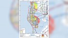
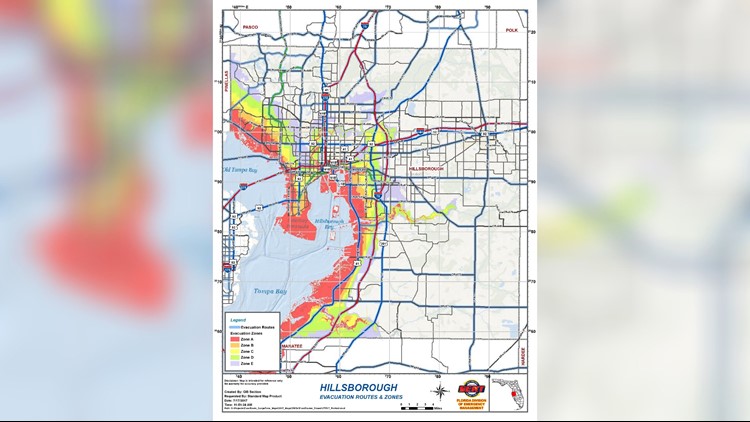
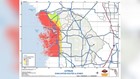
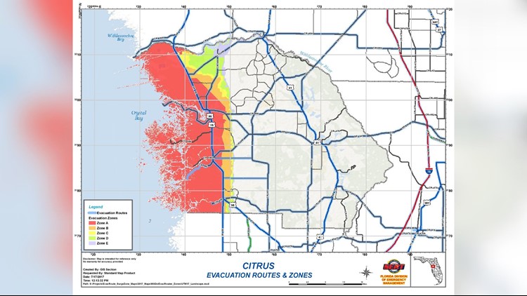
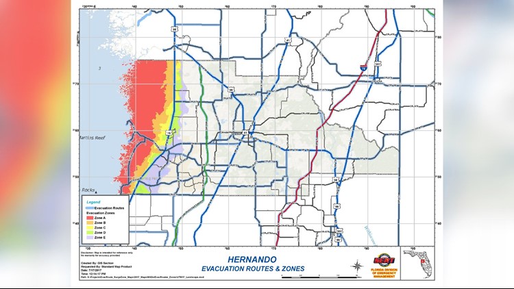
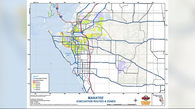
The Florida Division of Emergency Management has a map for each county posted on its website, showing generalized evacuation zones and accessible routes.
An important caveat: they are posted as a reference and any specific evacuation order is issued by local emergency managers.
Find the nearest shelter to you: Click here
The two biggest evacuation routes, if necessary, are I-75 north to the George state line and I-4 into Orlando. This year, the Florida Department of Transportation will not be reversing the lanes to one-ways.
Instead, crews will open the shoulders to make room for all the traffic.
Tolls across the state have been suspended.
Track the tropics: Download the 10News app
If you cannot see the pages below, visit floridadisaster.org.
Photos: Know your zone - Tampa Bay-area evacuation zones and routes


►Make it easy to keep up-to-date with more stories like this. Download the 10 News app now.
Have a news tip? Email desk@wtsp.com, or visit our Facebook page or Twitter feed.