
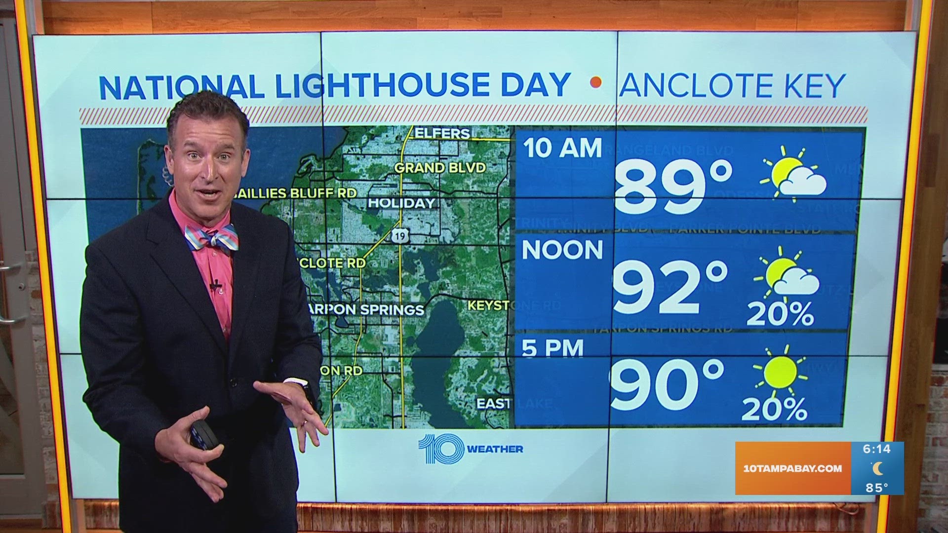
TAMPA, Fla. — The too-hot and too-dry summer pattern is back this week and a heat advisory is in place for your Monday. It will be in place from 11 a.m. to 7 p.m.
This comes on the heels of our hottest July on record at the Tampa International Airport with severe and extreme drought conditions continuing along our coastal counties.
This hot and dry pattern is the function of a huge heat dome taking up much of the deep South from Florida all the way to California. High pressure causes sinking air, which compresses and heats up keeping a lid on rising air and our typical shower and thunderstorm activity this time of year.

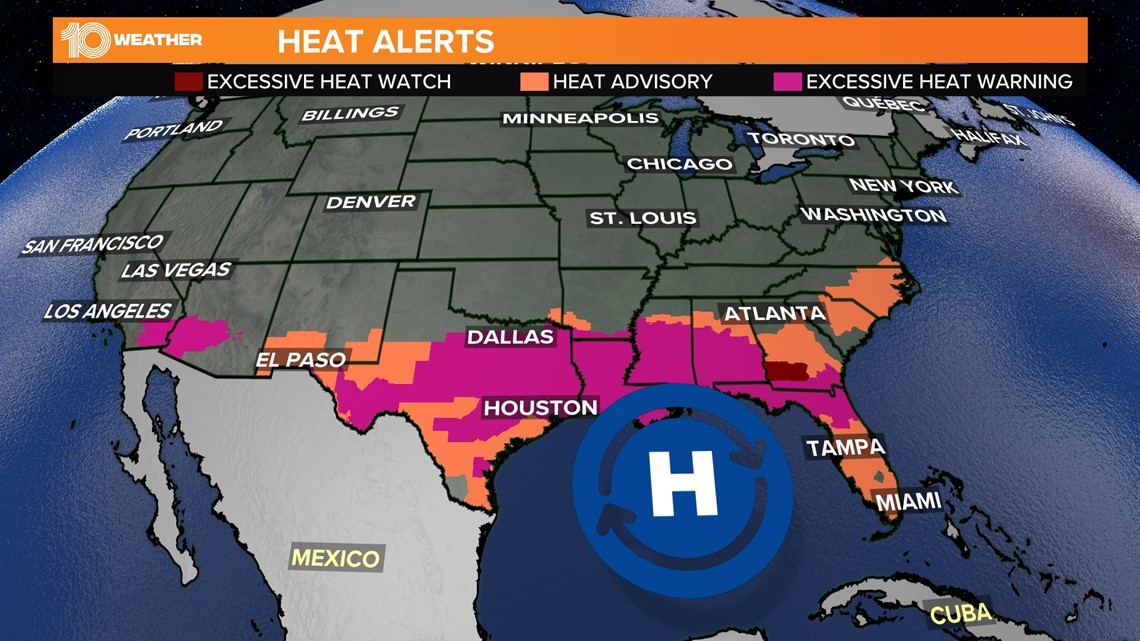
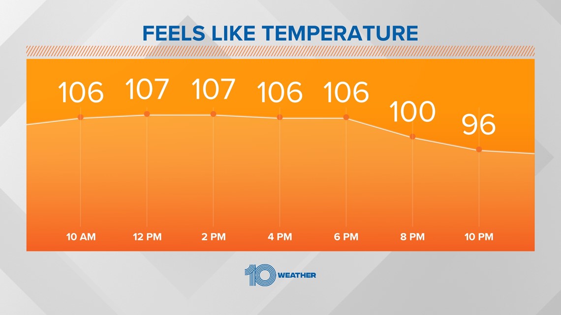
Without our cooling showers and thunderstorms, temperatures will continue well above average in the middle-to-upper 90s. When you factor in a hot west wind off the bathwater-feeling Gulf of Mexico this will bring humidity levels to the miserable range and feels like temperatures in the dangerous range from 105-115.
Make sure you slow it down and take heat precautions. Your body is not able to effectively cool itself down once that feels-like temperature is above 105.

Make sure when you are preparing kids for back to school this week make sure they have plenty of water for lunch and proper heat gear. Not only will heat advisories be likely most of the week but record-breaking temperatures are possible, especially by Tuesday.
While keeping yourself cool during the heat, remember these few tips:
- Stay hydrated throughout the day
- Stay inside with the A/C if you can
- Stay out of the sun if you're outside
- Check on your family and friends, especially the elderly