
SAINT PETERSBURG, Fla. — The record-setting activity of the 2020 season continues, and it's really no surprise as we approach the peak of the Atlantic hurricane season on Sept. 10.
Much more activity is brewing off the east coast of Africa -- as well as in the western Atlantic and Caribbean -- where multiple areas of interest will have the potential to develop over the next week or so.
Let's start with the two waves in the Caribbean.

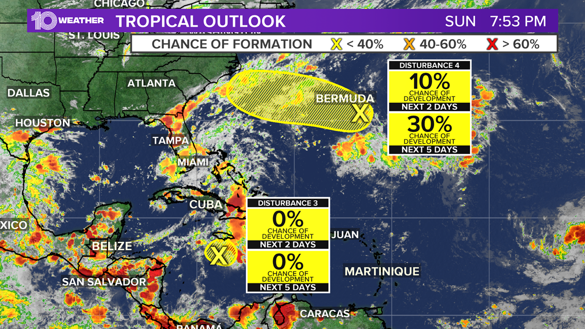
A tropical wave, labeled as disturbance No. 3, located in the central Caribbean is currently being monitored by the National Hurricane Center. As of Sunday, forecasters reduced its development chances as it heads westward into a vertically sheared environment that is not conducive to tropical formation.
Another wave, disturbance No. 4, popped up Sunday morning a couple of hundred miles southeast of Bermuda. Its activity is greatly disorganized and conditions are currently only marginally conducive for tropical development over the next several days as activity drifts west-northwestward.


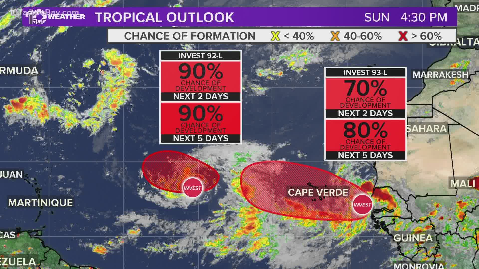
Heading back over to the African wave train, Invest 92-L is getting its act together as it continues to track west-northwest. Tropical development is expected, and a tropical depression is likely to form either later Sunday night or Monday. It currently has a 100-percent chance of development.
At this point, the system will be in the central tropical Atlantic. From there, many of the forecast models curve the system north away from land, but there is a lot of time and space for this system to evolve.
An additional tropical wave, Invest 93-L, is located just off the coast of west Africa. Gradual development of this system is expected, and a tropical depression could form this week while it moves generally westward over the far eastern tropical Atlantic. It currently has an 90-percent chance of development.
Similar to the leading tropical wave, at this time, this system is also projected to curve north away from land, but it needs to be watched closely.
And finally, the NHC added a new area to watch Sunday evening, as a wave is expected to move off of the coast of of Africa later this week. Gradual development is expected as it moves to the west, but it currently has a low chance of developing over the next five days.

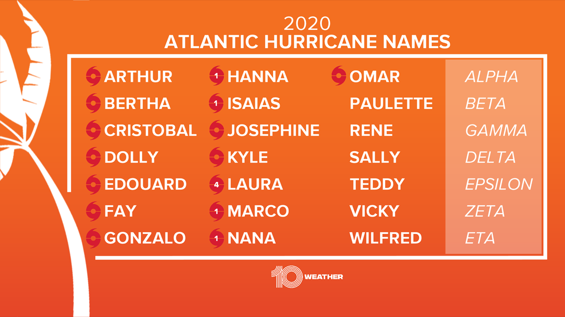
Hurricane season runs through November and the 2020 Atlantic hurricane season is well on its way to having the most named storms on record. There have already been 15 named storms.
The most active season on record was in 2005 when there were 27 named storms.
►Breaking news and weather alerts: Get the free 10 Tampa Bay app
►Stay In the Know! Sign up now for the Brightside Blend Newsletter