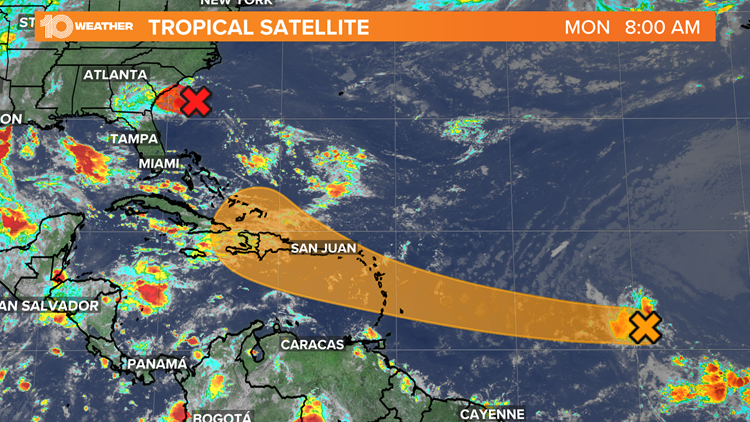
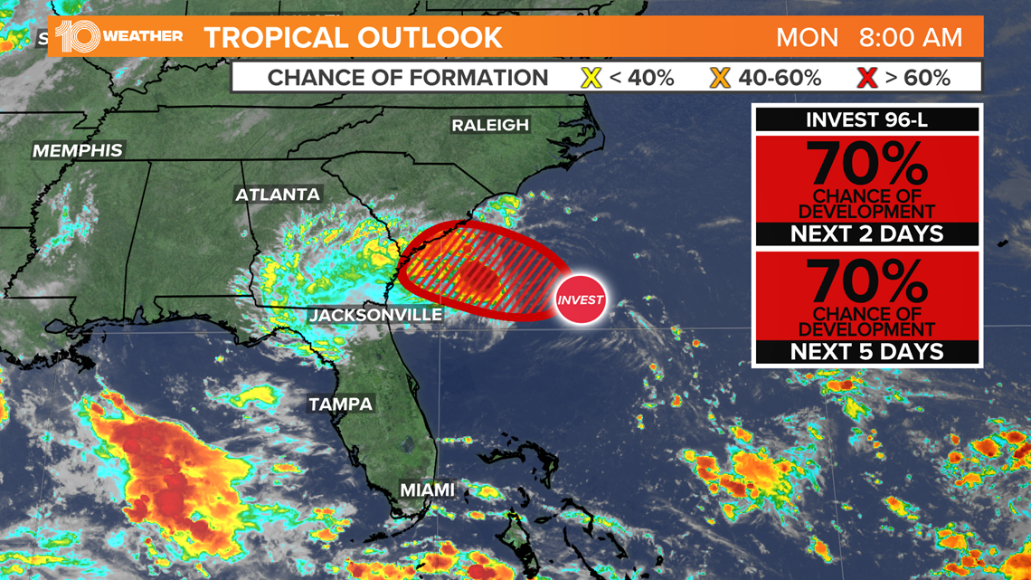
The National Hurricane Center is busy tracking two disturbances in the Atlantic, including a disturbance, Invest 96-L, about 190 miles off the coast of South Carolina. It could reach South Carolina or Georgia by Monday afternoon. Northeast Florida may also see some increased wind and rain chances.
An Air Force Reserve Unit reconnaissance aircraft is set to investigate the system Monday afternoon.
While it can't be ruled out that Invest 96-L develops into a tropical depression or tropical storm, it won't have much time to develop.
Regardless of development, a few inches of rain are possible along the immediate coasts of Georgia and southern South Carolina through Tuesday.

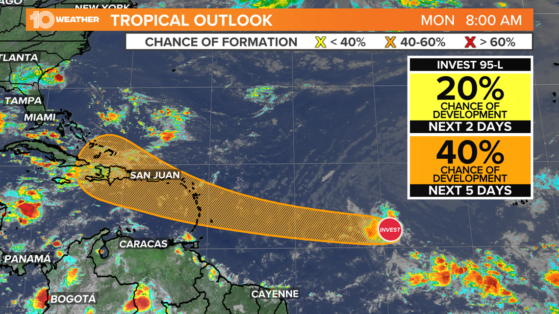
Nearly 2,700 miles to the southeast of Invest 96-L is Invest 95-L.
As of Monday morning, the NHC continues to give this disturbance a 20 percent chance of development into a tropical depression over the next 48 hours and a 40 percent chance over the next five days.
Invest 95-L is currently about 900 miles south-southwest of the Cabo Verde Islands, over the central tropical Atlantic Ocean.
The NHC says the disturbance is producing disorganized showers and thunderstorms.
Little, if any, development of this system is expected for the next couple of days, followed by some gradual development by Wednesday and continuing through the end of the week while it moves westward to west-northwestward at about 20 mph.

- 'Deep fire' slowing rescue effort at collapsed Surfside condo
- Concrete cracking, 'major' structural damage reported at Surfside condo in 2018
- Derek Chauvin sentenced to 22.5 years for the murder of George Floyd
- Jury spares convicted murderer Ronnie Oneal III, recommends life sentence
- A Frank Conversation: New podcast explores race, religion, politics and more
►Breaking news and weather alerts: Get the free 10 Tampa Bay app
►Stay In the Know! Sign up now for the Brightside Blend Newsletter