ST. PETERSBURG, Fla. — If you’re familiar with summers in Tampa Bay, then you likely know that a trip to the beach quickly becomes less refreshing, especially from July through September.
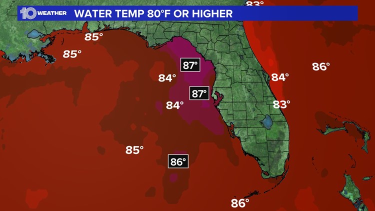
That’s because this is the time frame where water temperatures in the Gulf of Mexico normally range from 85-90 degrees, a temperature that most locals refer to as “bathwater” territory.
Yeah, not very refreshing to think about either!
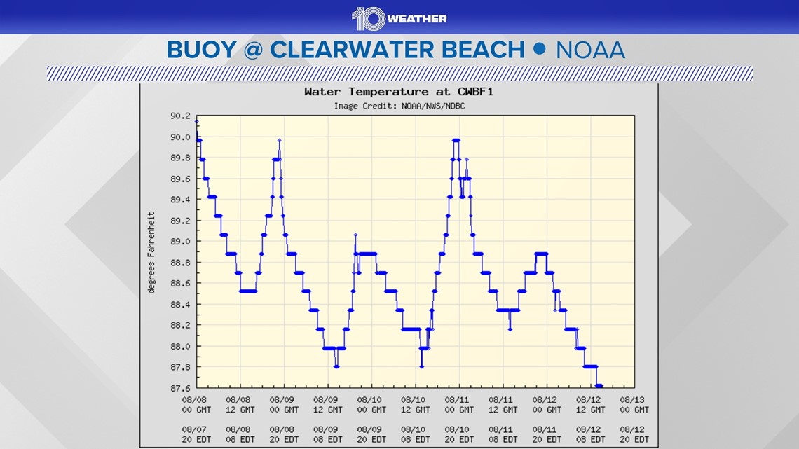
As it stands currently through the first half of August, we are steadily averaging temperatures in the upper 80s, according to the NOAA buoy at Clearwater Beach. This is the same buoy that recorded 90-degree temperatures earlier this summer.

There are several factors to take into consideration when monitoring water temperatures, such as solar radiation, temperature of any surroundings and the wind that may influence those surroundings, as well as any changes in atmospheric patterns throughout the season.
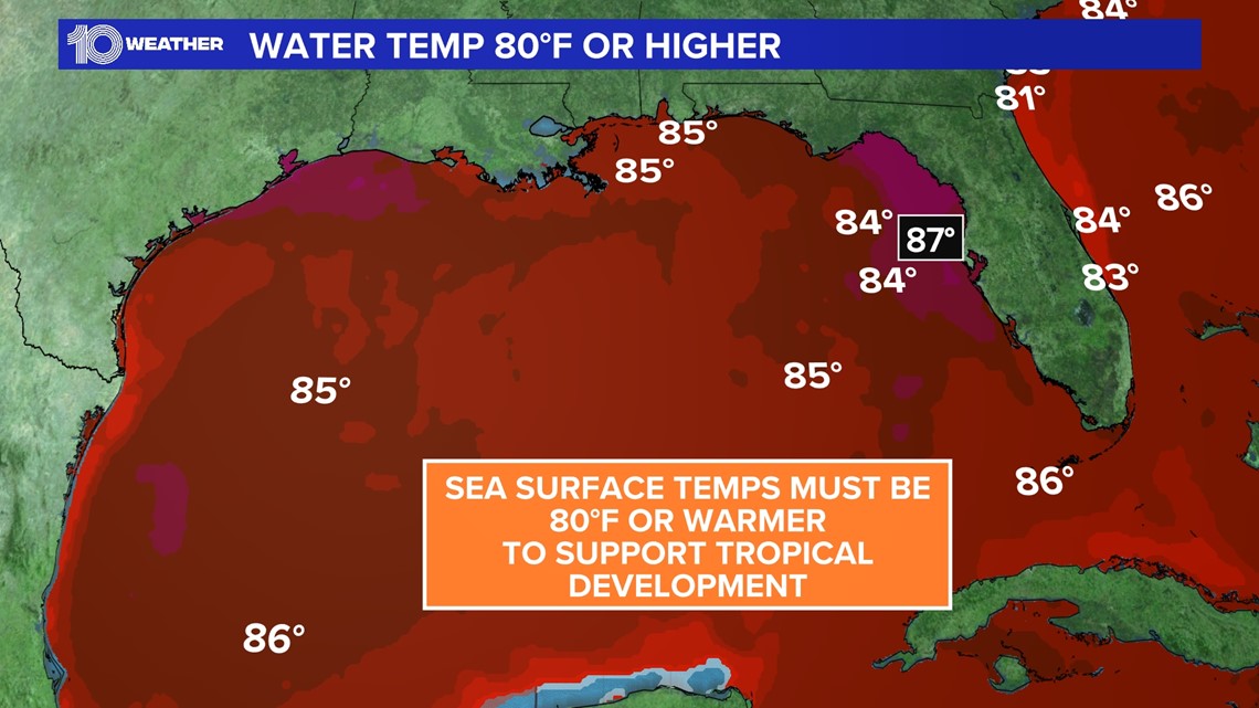
The sweet spot for tropical development is water temperatures over 80 degrees. And since the ocean has a higher heat capacity than land, it can retain a great deal of heat for a longer period of time without major fluctuations throughout the day.

So, if water temperatures are prime for development, then where are those pesky tropical waves?
Well, you can thank the recent waves of Saharan dust!
Warm water isn’t enough on its own to generate tropical activity. You also need low wind shear and plenty of moisture. We’ve got warm sea temperatures, but these plumes of dust provide very dry, sinking air, along with some excess wind shear over the tropics — all the things that tropical systems can’t thrive in.
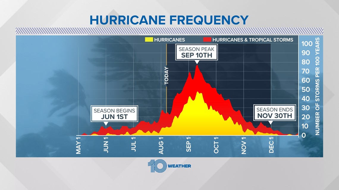
Despite how quiet things have been lately in the tropics, now is not the time to let our guard down. We are still on track for a very active season.
It is typical for plumes of Saharan dust to emerge off the coast of Africa and travel across the Atlantic from June through August. However, it is likely that once those dust plumes become less frequent, we can expect to see improving conditions for tropical development. Especially as we approach the statistical peak of hurricane season in September.

We already have the above-average sea temperatures in full swing. It’s now just a matter of time before increasing moisture and lower wind shear return to the mix, just in time for the most active part of the season.