
ST. PETERSBURG, Fla. — Tropical Storm Marco -- already a weak storm -- made landfall around 7 p.m. near the mouth of the Mississippi River.
It had maximum sustained winds of about 40 mph, well off its earlier hurricane status after strong wind shear in the region helped to disorganize the system.
Marco since has become a depression with 35-mph winds, and it is moving west at about 9 mph along the Louisiana coastline as of the National Hurricane Center's latest advisory.
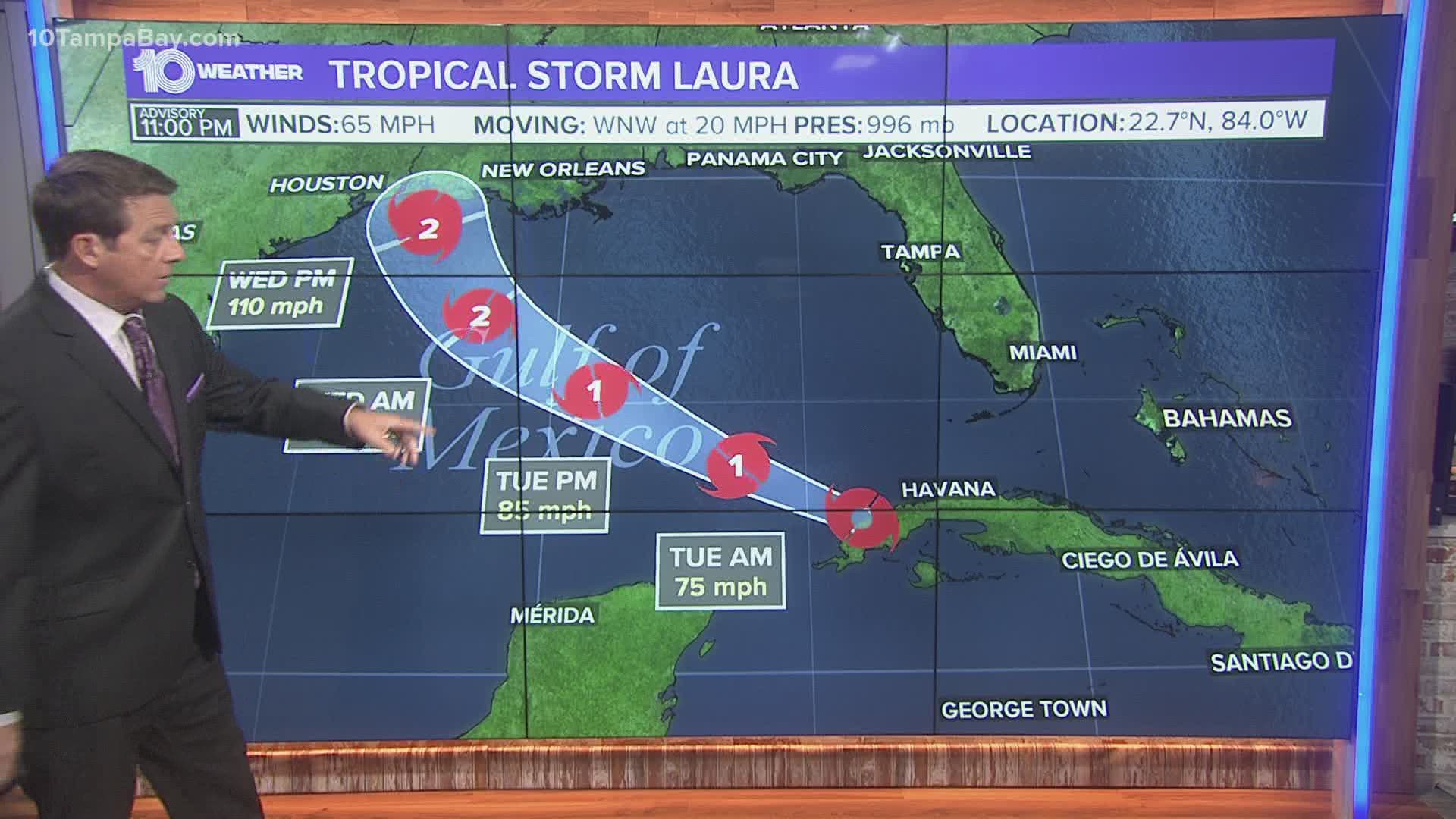
While this threat has been eased, the northwestern Gulf Coast is bracing for a Category 2, possibly a Category 3 hurricane, with winds more than 105 mph from the next system on way to the Gulf of Mexico -- Tropical Storm Laura.
While all warnings connected to Marco have been canceled Monday, another round of hurricane watches and storm surge watches have gone up for portions of the northwest Gulf Coast in anticipation of Tropical Storm Laura.
The National Oceanic and Atmospheric Administration (NOAA) updated its 2020 hurricane season forecast earlier this month, indicating one of the most active seasonal forecasts that NOAA has produced in its 22-year history of hurricane outlooks.
The updated forecast call for 19-25 named storms, 7-11 hurricanes and 3-6 major hurricanes.
We are heading toward the peak of hurricane season, and 10 Tampa Bay wants you to be prepared. Head to your Hurricane Headquarters at 10TampaBay.com/tropics for everything you need to know.
►Breaking news and weather alerts: Get the free 10 Tampa Bay app
►Stay In the Know! Sign up now for the Brightside Blend Newsletter