ST. PETERSBURG, Fla. — Did you know that the sun drives all our weather here on Earth? It is also the driving force behind sea breezes that develop across the Florida peninsula.
How does a sea breeze develop?
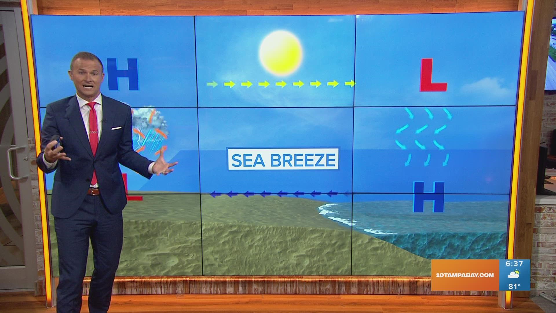
It's all about temperature differences, which make pressure differences — that then develop winds to produce storms! Sounds complicated? It's really not, let's break it down!
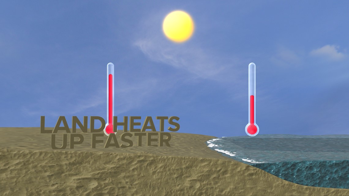
First, let's start with the sun! As the sun gets higher and higher in the sky, the air above the land heats up faster than the air above the water.

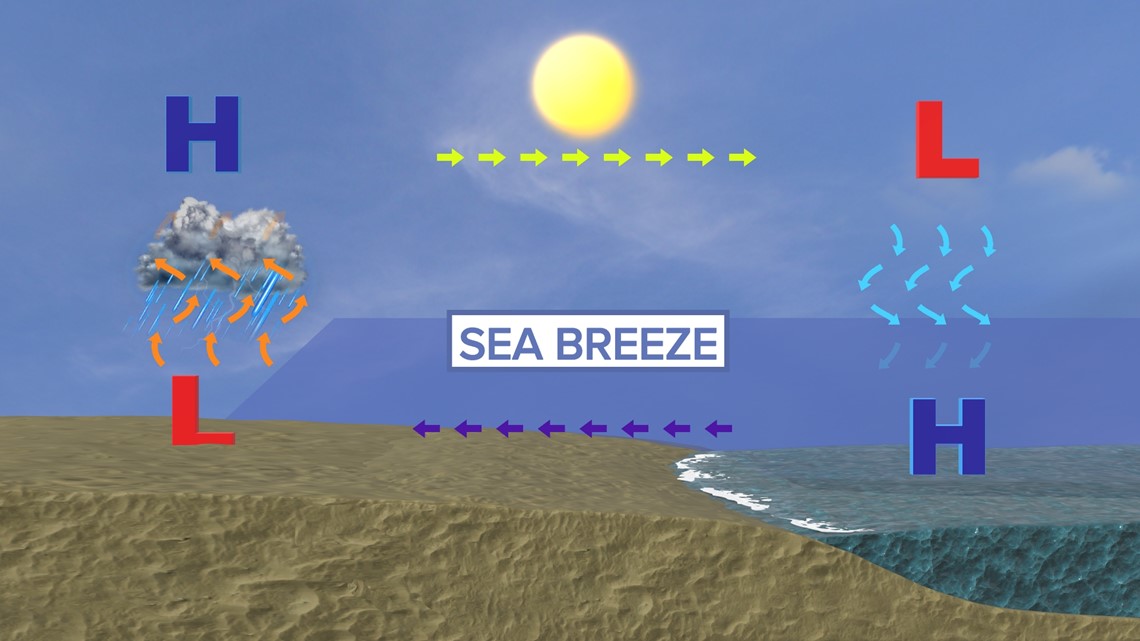
Most of us have heard the saying "warm air rises and cold air sinks" and that applies to the sea breeze. The air that gets heated up across the land starts to rise, creating low pressure at the surface. The cooler air over the water then moves in to replace the rising warm air.
This develops a mini cold front or sea breeze. Over a few hours, this can push further inland. Along that boundary, you have convergence (winds coming together) and extra lift that can spark off shows and storms.

When sea breezes collide, like the east and west coast sea breezes here in Florida, more storms can develop and can become stronger for a period of time.
What determines where the sea breeze and storms set up?
To put it simply, the flow in the atmosphere! Even before a sea breeze develops you will have a general wind pattern in the atmosphere or something that we call "flow."
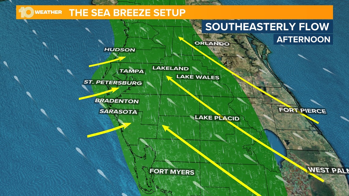
This all has to do with where high and low pressures are. In a normal summer pattern, the Bermuda high sits off the southeast coastline. It will shift and move, but our normal flow will be out of the southeast or southwest. And it is that east or west component of the wind that will determine who sees the highest rain chances.

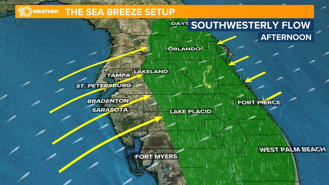
For example, if the flow is out of the southwest, storms will develop and push east quickly toward the central and eastern parts of the peninsula. The opposite happens when the flow is out of the southeast.
The wind pattern keeps the storms closer to the coast and higher rain chances across the Tampa Bay area.