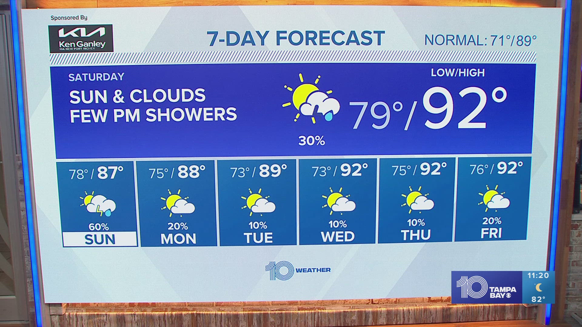
TAMPA, Fla. — Find those gloves and unbox that parka, the coldest air in several years is on its way to Florida.
This weekend's cold blast has been thousands of miles in the making! Originating in the Canadian arctic, the polar air mass pushing into the region is a part of a strengthening winter storm system. It's already made headlines for flight cancellations and delays given that snowfall in parts of New England could measure in feet.
But for those in the Sunshine State, this chilly air will be dry. We're talking no snow, no rain, just blue sky — and gusty winds.
Take a look at what to expect:
Overnight Friday, Saturday morning

Hit-or-miss raindrops will accompany the approaching cold front late Friday night. This won't amount to anything significant, so there's no need to cancel any evening plans. Temperatures that warmed up into the 60s during the day will begin to fall as the wind picks up from the northwest, bringing in the first bit of cold air.
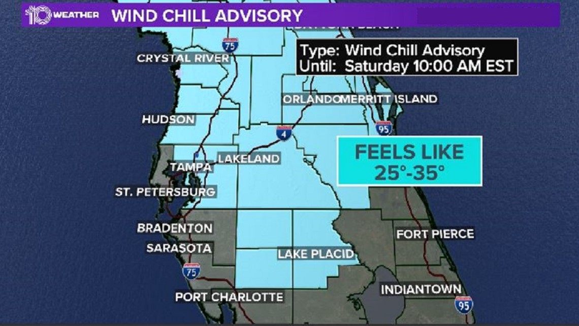
During the overnight hours and going into early Saturday morning, the temperature will continue falling as the wind picks up. Expect sustained winds from 10-20 mph, with gusts to 25-30 mph at times.
With a temperature in the low 40s and gusty winds, we start to incorporate the wind chill — or what the temperature "feels like" given the winds. A widespread area across the Tampa Bay region will see those readings running 25-35 degrees!
Saturday afternoon

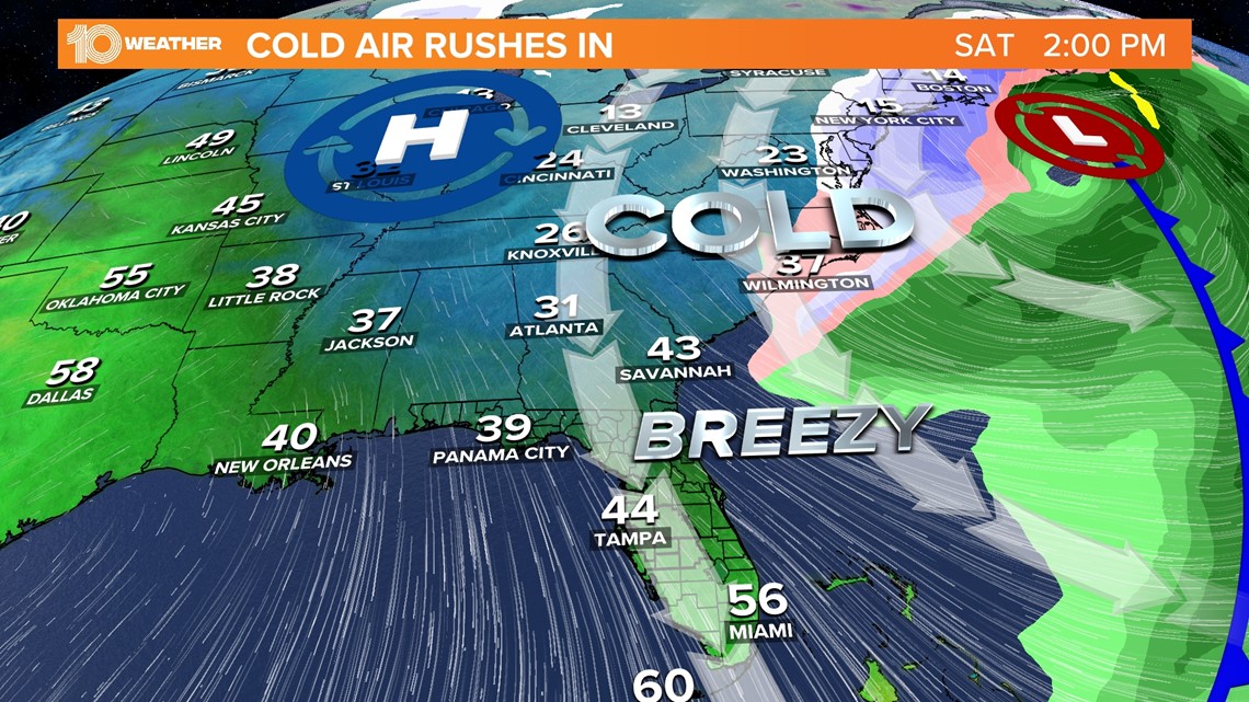
The cold air is here to stay, even during the daytime. Relentless northwest winds, still gusting around 25 mph at times pushing in the chilly weather, will make it difficult for temperatures to climb above 50 degrees.
Aside from the winds blowing in cold air, they'll whip up the surf, too. This will cause problems for small boats on the Gulf of Mexico, Tampa Bay and inland waters. It's because of this threat that Gasparilla Pirate Festival organizers are pleading with people to enjoy the party on land this year.
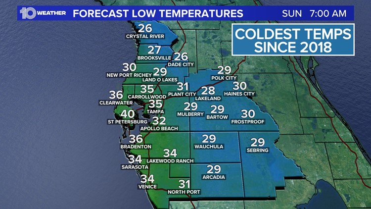
Saturday night, Sunday morning

It is then late Saturday through early Sunday morning that we officially welcome in the coldest air of the season! While the strongest winds will have dwindled down, there will still be a cool northwest breeze under completely clear skies.
This combination will have overnight lows falling in the middle 20s to the middle 30s by Sunday morning, with the chilliest locations being further from the water.
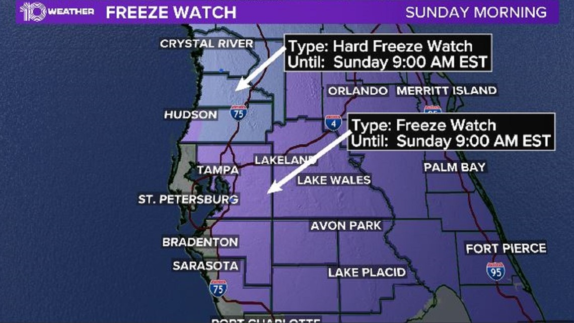
Due to these frigid temperatures sticking around for several hours, a Freeze Watch has been issued for most of central Florida from 1 a.m. to 9 a.m. Sunday due to sub-freezing temperatures falling as low as the upper 20s.
However, a Hard Freeze Watch will be in place for inland Pasco, Hernando and Citrus counties from late Saturday night until 9 a.m. Sunday due to temperatures falling as low as 25 degrees.

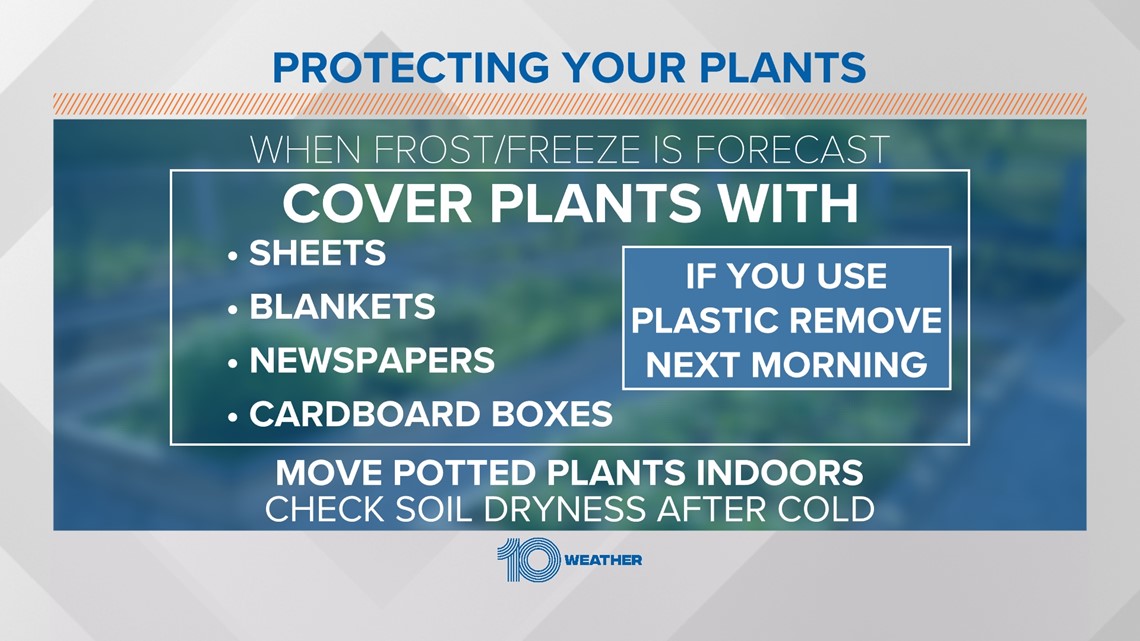
The primary concern with these frigid overnight temperatures will be the impact on crops, as these temperatures can kill sensitive vegetation, as well as potentially damage unprotected outdoor plumbing.
Stay tuned throughout the weekend for all the latest updates from our 10 Weather Team.