
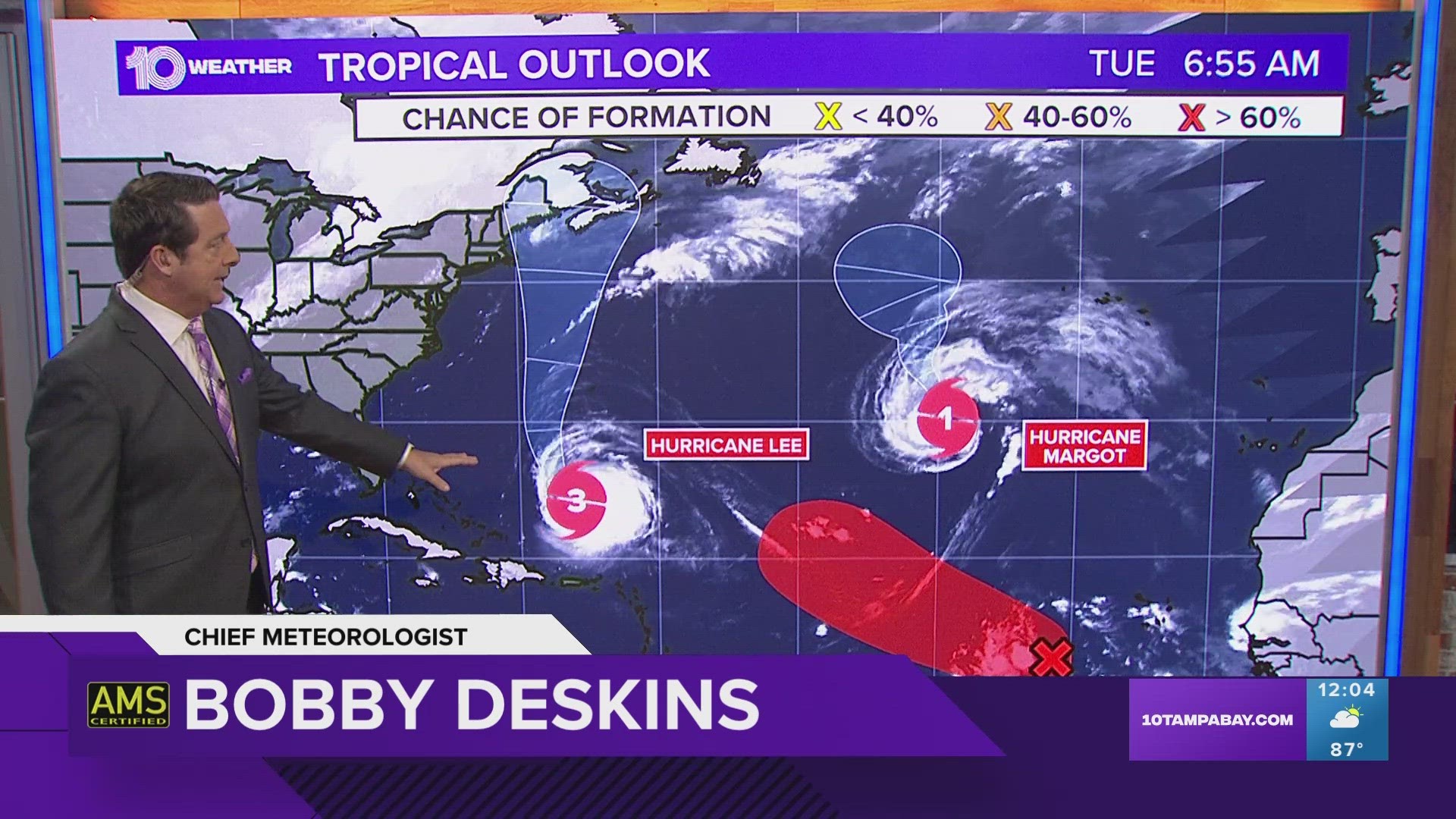
ST. PETERSBURG, Fla. — Hurricane Lee — once a Category 5 storm last week — is holding on strong as a Category 3 storm.
The National Hurricane Center's cone of uncertainty, which only shows where the center of the storm could go, keeps the storm north of the Caribbean islands before turning north. It's possible parts of the northeastern U.S. could feel impacts from the system.
Regardless, the entire East Coast will see dangerous rip currents and high waves through the weekend.
It's important to remember forecast errors increase farther out in time, so it's necessary to keep checking in on the forecast and be mindful that hurricane season runs through the end of November.
10 Tampa Bay is keeping you ahead of the storm: Download our free mobile app for real-time storm information and breaking alerts, and download 10 Tampa Bay+ for your favorite streaming device for live updates.
See below for the real-time tropical tracker, spaghetti models and more.
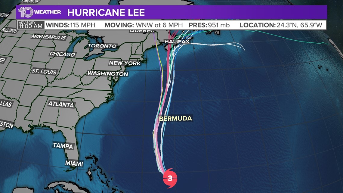
Spaghetti model
Resembling spaghetti noodles, each line in a spaghetti model represents a computer's best guess as to where the center of the storm will go.
These models, however, do not show expected impacts on areas.
Here's the latest spaghetti model for Hurricane Lee:

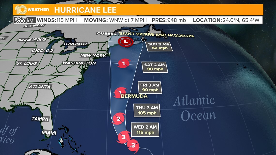
Tropical Track
This "cone of uncertainty" shows an area where the center of the storm could go, when and how strong it might be at the given time. Note that impacts from a tropical system do occur away from the center and outside the cone.
Here's the latest track for Hurricane Lee:

Watches and warnings
A tropical storm warning is in effect for Bermuda.
A tropical storm warning means that tropical storm conditions are expected within the warning area within 36 hours.
A storm surge warning means there is a danger of life-threatening inundation, from rising water moving inland from the coastline, during the next 36 hours in the indicated locations.
A hurricane warning means sustained winds of 74 mph or higher associated with a hurricane are expected within 36 hours. A hurricane warning can remain in effect when dangerously high water or a combination of dangerously high water and exceptionally high waves continue, even though winds may be less than hurricane force.
A hurricane watch means that hurricane conditions are possible within the watch area. A watch is typically issued 48 hours before the anticipated first occurrence of tropical-storm-force winds, conditions that make outside preparations difficult or dangerous.
A tropical storm watch means tropical storm conditions are possible within the watch area within 48 hours.