
ST. PETERSBURG, Fla. — After a slow start to the season, we are now at five named storms and two hurricanes. Both Hurricanes Danielle and Earl are still active in the Atlantic but are no threat to the United States, including here in Florida.
Tropical Storm Danielle
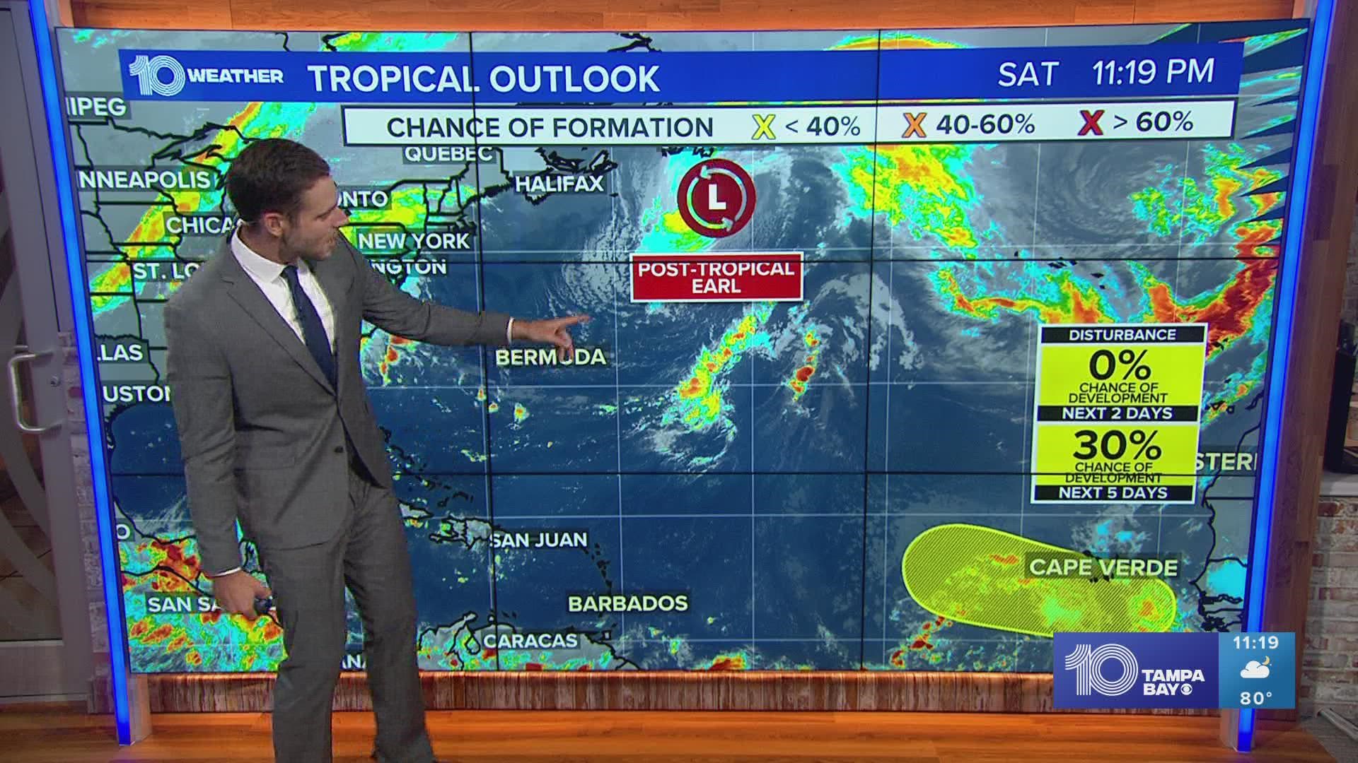
Danielle is expected to slowly weaken over the next few days and turn post-tropical. Some of the remnants could bring some breezy winds and heavy rain toward Portugal and Spain early next week.


Hurricane Earl
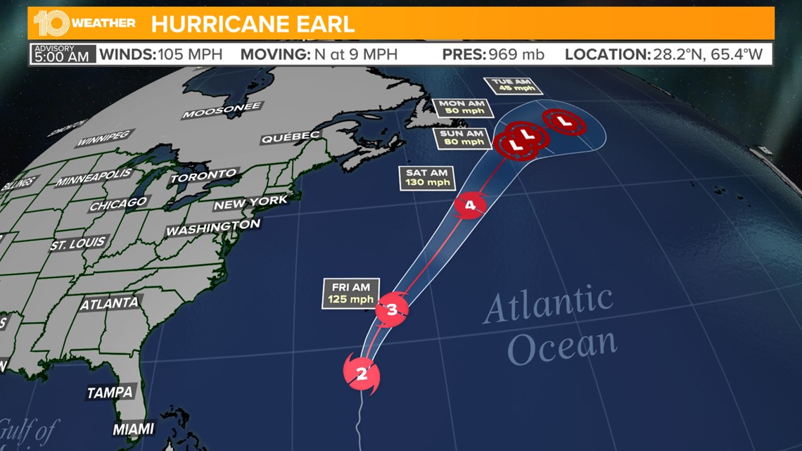
Hurricane Earl is continuing to strengthen with maximum sustained winds at 105 mph as of 5 a.m. Thursday. Earl is expected to continue to strengthen throughout this week, potentially becoming the first major hurricane of the season as it passes just east of Bermuda.
Bermuda is currently under a tropical storm warning and a hurricane watch.

Areas to watch
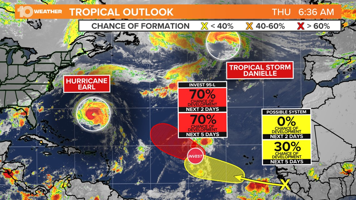
Along with two hurricanes currently in the Atlantic, there are also two areas to watch. Invest 95-L is a tropical wave in the eastern Atlantic with a 70% chance of development over the next five days. This disturbance is expected to move to the west-northwest and then recurve quickly to the north, keeping it out in the middle of the Atlantic.
While some development is possible this system is not forecast to become very strong.
Another tropical wave is coming off the coast of Africa and has a 30% chance of developing over the next five days. While the odds of development are not currently high, this is still a system we will need to watch more closely.
The wind pattern, with a blocking high to the north, might keep this disturbance further to the south. This means it may cross the central Atlantic and potentially approach the Caribbean islands. It's something to watch but nothing to get concerned about.

Overall, the Atlantic will remain more active, but the pattern is expected to keep those storms away from the United States. The Gulf of Mexico and the Caribbean still look very quiet.
Where are we now?
Even with the recent uptick in activity, this season is still running below average. We have seen five named storms but should be over seven when compared to average. Two hurricanes put us only one hurricane behind average.
No major hurricanes this season also signal a below-average season to date. On average, our first major hurricane, Category 3 or higher, develops on Sept. 1 and the second on Sept. 19. If Earl develops into a major hurricane, as forecast, that would put this season closer to average.
The Accumulated Cyclone Energy (ACE) for the season takes into account how long and how strong storms have been. Through Sept. 7, our ACE is at 19.1, which is well below the average of 51.1. An average season ends with an ACE of 122.5.

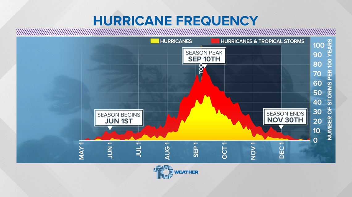
We are almost at the peak of the season! Sept. 10, this Saturday, marks the peak of activity in the Atlantic. After that, the tropical climatology starts to drop off, but we still can not let our guard down with 84 days left of hurricane season!