
ST. PETERSBURG, Fla. — The peak of hurricane season may be just in our proverbial rear-view mirror, but it's not the time to let our guard down — the season doesn't officially end until Nov. 30, so there's a lot of time left.
The good news right now is that Florida and the United States are not under an immediate threat from any tropical systems making landfall. However, much of Florida's East Coast is under a "high" risk for dangerous surf and rip currents, thanks to how big Hurricane Lee is.
Let's take a look at what the tropics are doing right now, according to the National Hurricane Center.
First, let's start with the biggest storm out there right now — Hurricane Lee. As of the latest advisory, Hurricane Lee is holding strong as a Category 3 storm, with maximum sustained winds reaching 115 mph. The storm isn't moving very fast; only going west-northwest at 6 mph.
While Lee's center is steering clear from land, because of its size, it could still impact all of the U.S. East Coast with dangerous surf and rip currents. Right now, Lee's hurricane-force winds extend 80 miles from the center of the storm and tropical-storm-force winds extend outward up to 185 miles.
Tuesday morning, the NHC said a tropical storm watch had been issued for Bermuda.
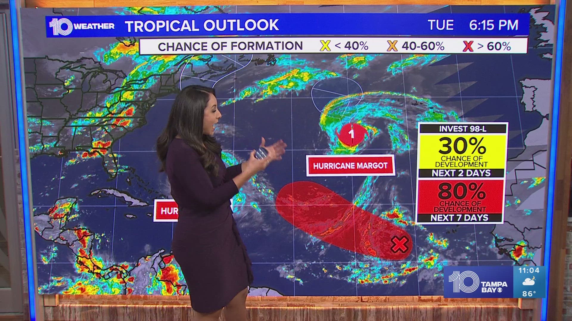
The next system the NHC is monitoring is Hurricane Margot. The NHC says Hurricane Margot is turning to the north at 12 mph. Short-term fluctuations in strength are possible, but forecasters don't expect Margot to change much in strength.
Margot is expected to steer clear of any land and won't be a threat.
Elsewhere in the Atlantic, the NHC is monitoring two systems that are about to merge in the Eastern Atlantic.
RELATED: As Hurricane Lee grows in size, Florida's East Coast to experience dangerous surf, rip currents
Essentially, the NHC is already treating invests 97-L and 98-L as one and the same. These two broad areas of low pressure sit over the eastern tropical Atlantic. The two lows are expected to merge within the next couple of days. Once combined, the system will likely become a tropical depression by the weekend. It will also move pretty quickly either west-northwestward or northwestward at about 15 mph.
Currently, there's a high 70 percent of development over the next seven days.