
TAMPA, Fla. — Hurricane Idalia is starting to get stronger and is moving faster, bringing threats of storm surge and tropical storm-force winds to much of the west coast of Florida, including all of the Tampa Bay area.
Idalia became a Category 1 hurricane early Tuesday morning and is expected to intensify into a major hurricane before making landfall somewhere along the Florida coast by midweek.
While keeping informed, prepared and connected on this storm, you may have heard our 10 Tampa Bay meteorologists talk about "rapid intensification" when it comes to Idalia.
But what exactly does that mean? And how does that affect you as you prepare for the storm?
To put it simply, rapid intensification means the maximum sustained winds of a tropical cyclone increased by at least 30 knots, or about 34.5 mph, within a 24-hour period, according to the National Hurricane Center.
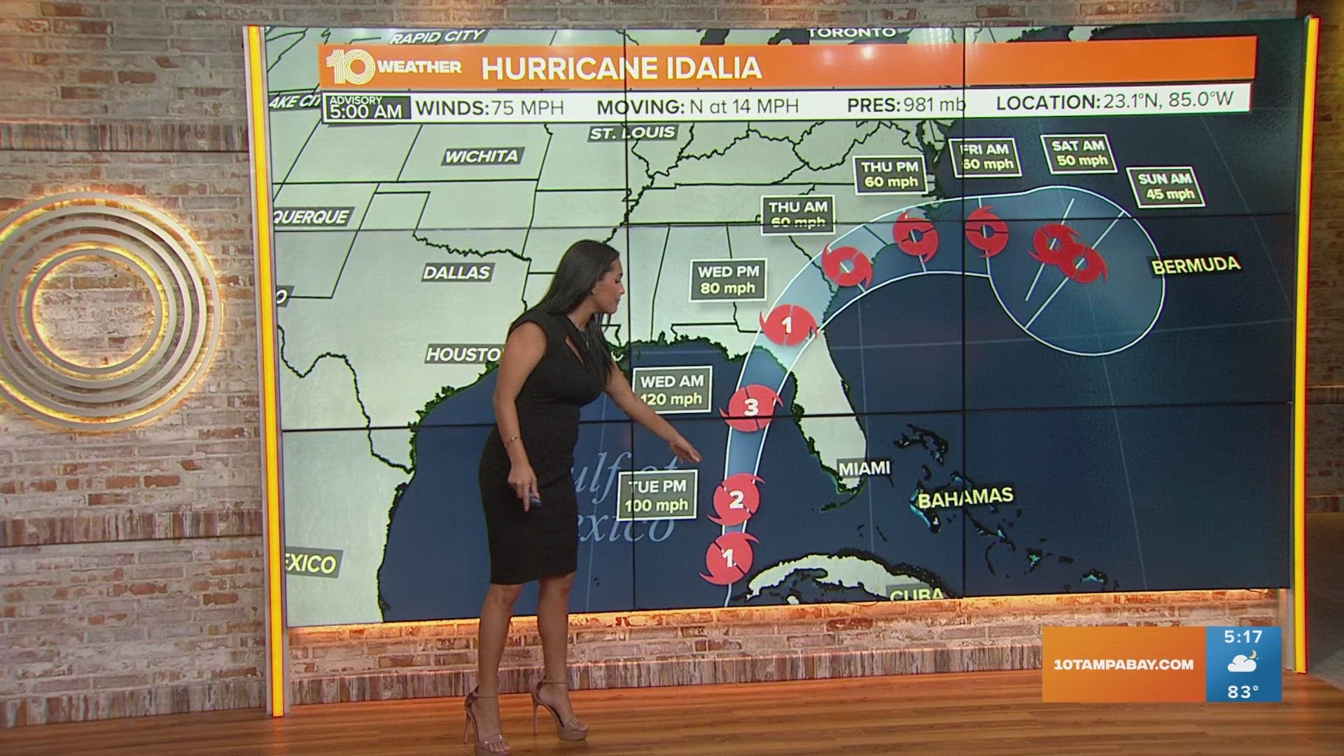
As of the latest advisory from the NHC, Idalia has maximum sustained winds of about 75 mph. In order for the storm to undergo rapid intensification, the storm would need to increase its maximum sustained winds to at least 109 mph over the next 24 hours. Those wind speeds, for context, would put Idalia at a Category 2 storm.
According to the Saffir-Simpson Hurricane Wind Scale, here's how hurricane forecasters break down hurricane strength:
- Category 1: Wind speeds between 74-95 mph; very dangerous winds will produce some damage
- Category 2: Wind speeds between 96-110 mph; extremely dangerous winds will cause extensive damage
- Category 3: Wind speeds between 111-129 mph; devastating damage will occur
- Category 4: Wind speeds between 130-156 mph; catastrophic damage will occur
- Category 5: Wind speeds over 156 mph; catastrophic damage will occur