
ST. PETERSBURG, Fla. — The active hurricane season of 2020 continues on as we enter the peak over the next month and a half. There already have been 11 named storms this year, and another two systems are already in the works.
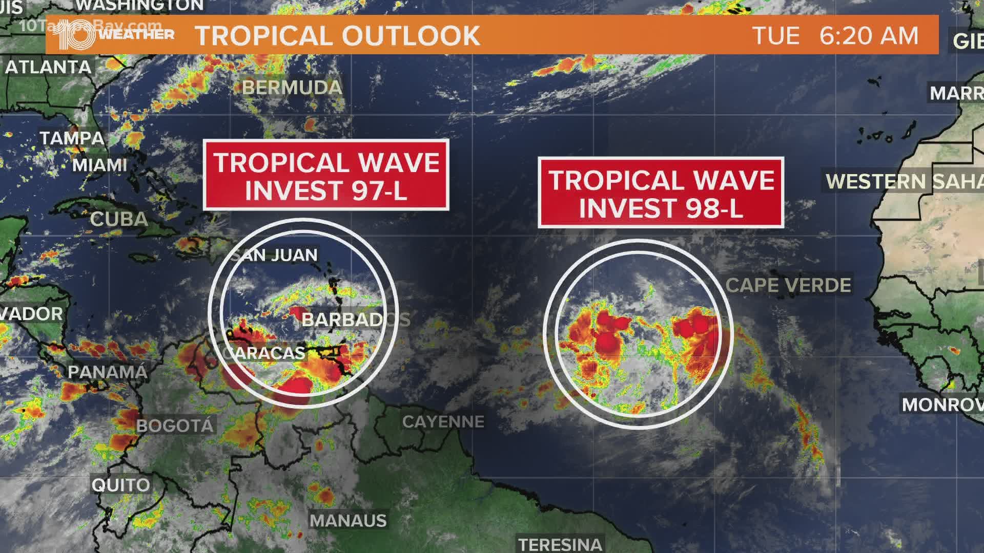
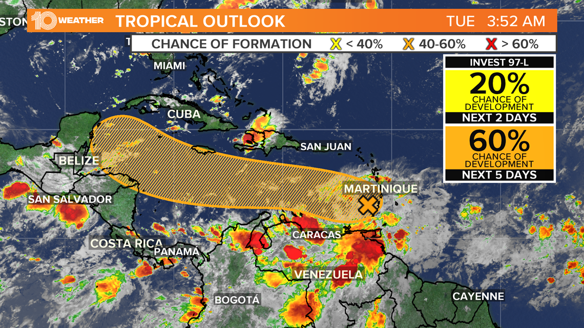
A fast-moving tropical wave located a couple of hundred miles east of the Windward Islands continues to produce disorganized showers and thunderstorms as of Monday evening. This wave, labeled Invest 97-L, is expected to move westward at about 20 mph during the next few days, and that fast forward speed is likely to limit significant development while the system moves into the eastern Caribbean over the next few days.
By the second half of the week, the system is expected to move more slowly westward across the western Caribbean, where conditions are expected to become more conducive for development into a tropical depression or tropical storm.
There is currently a 60-percent chance that it develops over the next five days, according to the National Hurricane Center. Regardless of development, locally heavy rainfall and gusty winds are expected over portions of the Windward Islands and the southern Leeward Islands beginning today through Tuesday morning.

Another tropical wave located over the eastern tropical Atlantic to the south-southwest of the Cabo Verde Islands is producing disorganized showers and cloudiness.
The wave is forecast to move westward at 15-20 mph during the next few days, and conditions are expected to become more conducive for development into a tropical depression by the end of this week. There is currently a high, 90-percent chance that this system develops over the next five days.
By this time the wave will be in the western tropical Atlantic.


The long-range track for both of these systems is uncertain at this time, but some forecast models bring both systems into the Gulf of Mexico. While there is no threat to Florida at this time, we must monitor both of these systems closely as they begin to develop later this week and track west through the weekend.
The National Oceanic and Atmospheric Administration (NOAA) updated its 2020 hurricane season forecast earlier this month, indicating one of the most active seasonal forecasts that NOAA has produced in its 22-year history of hurricane outlooks.
The updated forecast call for 19-25 named storms, 7-11 hurricanes and 3-6 major hurricanes. This includes the 11 storms and two hurricanes we’ve already seen.
►Stay In the Know! Sign up now for the Brightside Blend Newsletter